


– Click here for the recent interview given by Dave Truman on ‘Earth Ancients’, Tiwanaku, Ancient City of the Gods –
The Uru people, who are thought to have lived on the Altiplano for longer than most of its other inhabitants, maintain a tradition that deep beneath the waters of Lake Titikaka lie the ruins of a city of gold. Over the years, the story has been dismissed as a romantic fable, or the the idle fancy of an ‘uneducated’ people. The Urus’ tradition can be seen as the epitome par excellence of the lost grandeur of a world that lies forever just beyond our reach. It has an almost universal appeal, which is probably why we find similar stories from cultures around the world; not least Plato’s Atlantis. Yet, might there be some truth to this story? Could there really be remains of cities, their walls clad with sheets of gold, beneath the waters of this sacred Andean Lake? The proposition seems the very stuff of dreams, but curiously enough, there is a line that can be traced back through time to the prehistoric depths of Titikaka’s brackish waters. The line is not a straight one and it is often obscured by the tangle of legends and folktales that cling to Andean traditions; but it is there nonetheless.
Records of golden temples, if not golden cities
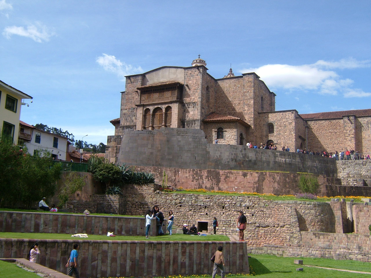
The Convent Church of Santo Domingo in Cusco, which was built on top of the solar temple known as the Corichancha. According to Inca Garcilaso de la Vega, the cloisters of the Coricancha were clad with sheets of gold.
©Dave Truman 2017. This image may be reproduced only for educational or informational purposes.
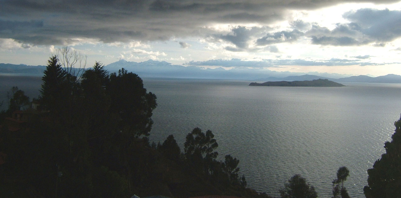
Gold-clad temples and palaces are not just the subject of ancient legends. The chronicler, Inca Garcilaso de la Vega (1539-1616) wrote that, until the arrival of the Spanish, Cusco’s Great Solar Temple the Corichancha possessed cloisters with walls covered with sheets of gold.i Elsewhere in his writings, Garcilaso tells us that the great Solar Temple on the Island of the Sun rivalled the Coricancha for the sheer sumptuousness of its gold and silver ornamentation.ii His reference to the Island of the Sun takes us right back to Lake Titikaka and the place where the Urus´ legend originated, but Garcilaso was writing about a time just before his own birth.

The great Solar Temple that once stood on the Island of the Sun. It was said by the chronicler Garcilaso de la Vega to have been adorned in gold so lavishly that it rivalled the Coricancha in terms of its splendour.
By Fergon – La Tierra y el Hombre Descripción pintoresca de nuestro globo y de las diferentes razas que lo pueblan de Federico de Hellwald. Traducción de Don Manuel Aranda y Sanjuan. Editado en Barcelona por Montaner y Simón, Editores (Calle de Aragón nums 309 y 311) el año de 1887; Public Domain
Neither should we think of the Urus as dreaming up some kind of pastoral bliss through their legend of a golden city. They have eked out their meagre existence on the harsh altiplano for thousands of years and have been able to do so only through closely observing nature. The French explorer Simone Waisbard spent many years collecting information about Titikaka. She recalled listening to an Uru fisherman telling her he had seen an entire city protruding above the surface of the Lake during a drought when the water-level had dropped some 13ft (4 metres). He added that this was undoubtedly a city belonging to someone called the Great Zapana, “who invaded the islands of the lake that then used to be governed by Mallku de Chucuito, who was defeated.”iii 1 This account is confirmed by another chronicler, Pedro Cieza de León (1520 -1554), who wrote that the native people informed him of a leader called Zapana, who had once ruled many cities now submerged within the Lake. iv
Ruins in the shallows and ruins in the depths
When one of the pioneers of modern archaeology, the American Ephraim George Squier (1821-1888), visited the northern part of Lake Titikaka in 1877, he came across some ruins submerged in the shallows on the edge of the Sillustani Peninsula. He could hardly discern any stonework, because they were covered with many reeds and other aquatic plants, but he eventually made out the shape of a straight wall, or breakwater, that ran from one side of the peninsula to the other. Squier concluded that the construction had once been originally well above the water level, but that an earthquake had caused the land to subside. Curiously enough, his reasoning agreed with local custom that speaks of the Lords of Hatun Kolla, who had to abandon their palace after it had been flooded, following a great earthquake. More prosaically, the local Aymara fishermen when asked about the ruins, said that they were visible at times when the water levels on the Lake were at their lowest.v
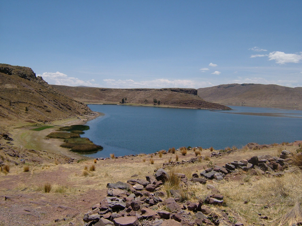
One of the shallow inlets of the Umayu Lagoon that borders the Sillustani Peninsula, just north of Lake Titikaka. The dark green plants clustered at the water’s edge are tortora reeds.
©Dave Truman 2017. This image may be reproduced only for educational or informational purposes.
Accounts of ruined cities, temples and other megalithic constructions are not just confined to Titikaka’s reed encrusted shores, however. In the 1930s, no lesser person than the Commandant of the Peruvian Navy, Antonio Rodríguez Ravitch, reported the existence of submerged megalithic ruins near to the island of Kispinike at the northern end of the Lake. His account was endorsed by an academic, Dr Espinoza Sorano, who claimed to have seen beneath the clear and deep waters, “temples of the Sun and Moon, of monolithic stones,” which he attributed to, “pre-Inca architects who belonged to a totally submerged civilisation.”vi It was, however, undoubtedly the stories of gold beneath Titikaka’s waters that prompted some of the first foreign under-water explorations of Titikaka in the last century. Not least amongst these legends have been those concerning an immense golden serpent-like chain. These stories were what first motivated the US professional diver William Mardoff to explore beneath Titikaka’s waters in 1956.vii
William Mardoff: underwater exploration and its challenges
Mardoff was not the first to encounter the unique challenges of diving beneath the waters of Titikaka. There had been Spanish and British explorations in the 1930s, but they had found no treasures. Lake Titikaka is not the ideal place to dive and presents distinct problems for the frogman, or woman. Before a diver even gets to explore the deep he or she has to contend with the lack of oxygen in the thin air surrounding the Lake, rendering even modest physical tasks exhausting. Then, there are the biting and freezing winds that can often blow up in a matter of seconds, whipping the Lake’s surface into a frenzy of icy waves. Such squalls often include lashing rain, or even worse, hail stones. Once submerged, the diver finds that Titikaka’s water is extremely cold, whatever the time of year, since the Lake is fed by mountain streams and rivers that run from the high peaks of the adjacent cordilleras. At this extreme elevation, sunlight penetrates deep beneath the Lake’s surface, which stimulates an abundance of vegetation, especially tortora reeds and algae. Aquatic plants readily cover every surface they can cling to, including any archaeological remains. Last but by no means least, there is the ever-present layer of mud, which accumulates to a depth of some 130 feet (40 metres) over the Lake´s bed.
Given such extreme conditions, it was hardly surprising that Mardoff did not find any colossal gold chain, or even any more modest golden votive offerings. After some twenty-five diving sessions, he gave up his quest. All he had to show for his efforts were a few ceramic pieces. Some said that his lack of success was because he had not shown sufficient respect for the dieties of the Sacred Lake, in that he had not appeased them before making his first dive. Certainly, Mardoff had needed to wait for a whole fortnight before the local fishermen eventually agreed to help him in his quest. As a solo diver, he should have welcomed any local information that they might have had to support his explorations. Just before he left Bolivia, Mardoff attended a dinner in La Paz that was given in his honour. Whether as a result of over indulgence at the fine banquet or not, Mardoff took the opportunity to speak about a marvellous city he had come across by accident during his under-water investigations. He told his fellow diners that it lay at a depth of about a hundred feet (30 metres) bemeath the Lake, near to the mouth of the Escoña River. It was close to a lake-isle that the local people regarded as enchanted. Mardoff waxed lyrical about the ruined city’s crumbling mud-encroached walls and the algae floating through its abandoned windows. Doubtless, some of the banquet’s Bolivian guests, who knew something of the ancient traditions of Titikaka, linked the diver’s mellifluous account to legends of the sunken City of Chiopata. The City was recorded in the local annals and was believed to have been near to where the North American had dived.viii
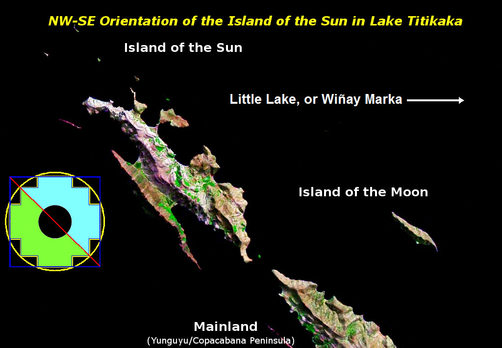
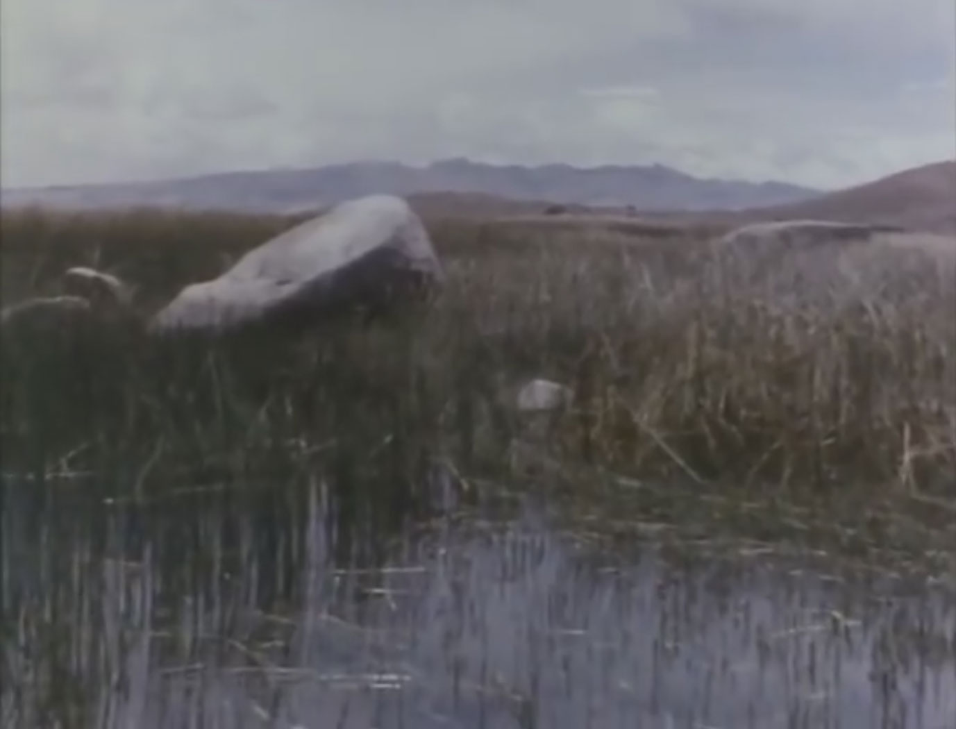
Map of the southern part of Lake Titikaka showing the tip of the Yunguyu Peninsula, where Peru borders Bolivia. To the right of the map is the little lake of Wiñay Marka, in which several underwater explorers have found polygonal megalithic ruins. It is possible that these may date from the Younger Dryas ´big freeze´ at the end of the last Ice Age when the little lake´s bed was dry. Significantly, Wiñay Marka in the Aymara language means ´The Eternal City’.
This work “Isla del Sol” is a derivative of an untitled picture by NASA WorldWind, Public domain, is used under CC by “Isla del Sol” is licensed under CC by Dave Truman and Tony Cross.
Whether Mardoff’s account was true or not, the idea of ancient sunken cities abandoned beneath Titikaka’s waters had begun to rise in the consciousness of Bolivians, even though no actual relics had yet been brought to the surface. In the decade that followed, another underwater expedition claimed to have seen the archaeological remains of buildings near to the Island of Simillaque. This was in the ‘little lake’ of Wiñay Marka, which lies to the south of the Yunguyu Peninsula. The success of these early underwater explorations was hampered by the ambivalence of the local Aymara people towards them. More often than not, they were reticent about helping the frogmen because they thought that they would enrage the lake’s spirits, or that the divers would remove votive offerings to deities that had themselves been given to the lake. Yet, Titikaka’s Aymara fishermen possessed an intimate knowledge of the lake; and especially of its submerged ruins, some of which occasionally peeped above the water’s surface. Their accounts of such places not only told of worked stones and walls, but often included the presence of deities and of strange beings that floated between the ruined megalithic structures. Too often, their stories suffered the fate of peremptory dismissal by the underwater explorers.
The Fer de Lance Expedition
The Argentinian diver Ramón Avallaneda learned of Mardoff’s encounter with a ruined city and was inspired to explore the Lake´s depths for himself. He obtained financial support from a Buenos Aires newspaper, as well as from the Bolivian government, and headed off for Copacabana in the company of two other divers. Avallaneda’s team began by diving directly above the place they thought that Mardoff had reported having seen the submerged city, but found nothing. Eventually Avallaneda decided to dive elsewhere after asking of one of the locals, who remembered having seen some ruined buildings on the opposite side of the Lake as a child. The change proved fruitful. The three frogmen emerged from the waters shouting in excitement and with a sense of triumph. At some 25ft (8 metres) below the Lake’s surface they had seen enormous worked blocks of stone, some of which were nested inside each other, like a gigantic jigsaw. They discovered whole walls, the stones of which had been cut regularly and which they described as, “in the Inca style,” although some suspected that they were much older.
The description of the megaliths beneath Titikaka’s waters as being interlocking, like a vast jigsaw, is particularly interesting because it is redolent of the kinds of polygonal megalithic structures found in parts of Cusco and in the ‘fortress’ of Sacsayhuayaman, which overlooks that city. It should be stressed here that polygonal megalithic architecture is a very different building technology from the megaliths that comprise Tiwanaku, or Puma Punku. At those sites, the megalithic blocks are usually rectangular and they do not interlock in the way that the giant stones of Sacsayhuayaman do. Nearly all conventional archaeologists attribute the construction of polygonal megalithic structures to the Incas, but others, who have studied them in detail, beg to differ. The Peruvian father and son, Alfredo and Jesús Gamarra, have made an extensive study of Andean megalithic architecture. They have concluded that it belongs to a much more ancient construction technology than any used by the Inca.ix In particular, they believe these massive polygonal structures to have been erected in the distant past; in an era which Alfredo Gamarra named the Uran Pacha.x

Some of the immense interlocking blocks of limestone at Sacsayhuayaman. Several of those who have dived beneath the waters of Titikaka report having seen the remains of constructions that resemble this stonework. Are those ruins the remains of buildings that existed before the altiplano flooded, at the very end of the last Ice Age?
©Dave Truman 2017. This image may be reproduced only for educational or informational purposes.
If the Gamarras are correct in the broad thrust of their assertions, then the discovery of polygonal megalithic buildings from the remote past beneath the waters of Lake Titikaka may be highly significant. To my mind, the Gamarras’ diligent observations of South American megaliths over many years suggest the existence of a Pleistocene advanced culture in the Andes that may have pre-dated the Younger Dryas event.2 In my previous article, I outlined how a flood, or floods, may have set the altiplano awash with the waters of the Pacific. Could it be that the interlocking stone megaliths seen by Avellenada and his team dated back to before the end of the last Ice Age?
The massive and interlocking three-dimensional jigsaw of a wall was not the only discovery made by Avallaneda´s team. In the days that followed, they found a paved road that ran parallel to the Lake’s coast, several hundred yards (metres) from the shore. They discovered a whole complex of structures that did not seem to conform to any architectural style yet found in either Peru or Bolivia, or so the archaeologists said. In this ‘complex’, there were some thirty walls running in parallel with each other. They were spaced about five metres/yards apart and were about the same height as a human. At one end, the parallel walls all joined the straight edge of a stone base, which was approximately 5/8 of a mile (1 km) long and resembled a half-moon when viewed from above. The base had been constructed from stone blocks that had been formed into cubes, each of their sides being about 2ft 4in (70cm) across. There are photographs and film that provided irrefutable proof of the existence of this strange construction.xi This ‘complex’ raised more questions than it answered. What function did this construction serve? Had it been a harbour when the level of the Lake was much lower than it is today? If so, how did the curious construction of thirty parallel walls provide any shelter against the fierce storms that are known to brew up on the altiplano?
It is quite curious that virtually none of these finds seem to be in the public domain today, especially in our current information-rich age. It is not just that no photographs or film have been posted on the internet; that in itself is baffling. It is that the work of Avallaneda´s team has not informed any of the most recent underwater expeditions. I have not found any records of what Avallaneda is reputed to have discovered, but a man who was perhaps the world’s most famous underwater explorer at the time did see his material. What was more, Avellenada´s pictures and film inspired him to launch his own underwater exploration of Titikaka.
Enter Jaques-Yves Cousteau
There were severe limits as to how much of the Lake’s three divers could explore. This much was patently obvious when Avallaneda met with the underwater explorer Jaques-Ives Cousteau. The Frenchman was resolved to find out more about the Lake´s depths, so he assembled a formidable team of seventeen people including divers, sub-aquatic camera operators, biologists and an underwater archaeologist, named Frédéric Dumas. Above all, Cousteau wanted to explore the Lake’s bed, most of which was at a depth far greater than any diver could descend to safely. He took with him two ‘sea fleas’, which were mini-submarines, each capable of carrying one person and of descending to a depth of 1,640 feet (500 metres).xii
Despite extensive reconnaissance of Titikaka’s depths and shallows, Cousteau’s exploration of the Lake did not live up to expectations. Although they could dive to great depths, the ‘sea-fleas’ faced their own problems beneath the Lake, because they had been designed for use in the sea. When submerged in the Lake, they needed additional buoyancy tanks attached to their outsides. The biggest challenge to Cousteau’s expedition was, however, the Lake itself. In the shallows, the frogmen had to contend with forests of tortora reeds. In the depths, there was the ubiquitous layer of mud to contend with, but here it was covered by an almost impenetrable growth of algae. Although Titikaka’s waters are usually limpid, any disturbance of the mire covering the Lake’s bed would send plumes of mud and dislodged algae directly into the fields of vision of the mini-submarines’ pilots, rendering their task virtually useless.

A submerged Stone, which appears to have been part of the masonry of an interlocking wall. This was filmed by the Cousteau team, presumably at great depth. Note the cloudy nature of the waters, which was probably a result of turbulence generated by Cousteau’s sea fleas. Every effort has been made to trace the copyright holders of the material reproduced.
Heads of cobras in South America
Having said all this, Cousteau’s expedition did make some fascinating discoveries. While Frédéric Dumas was exploring the Lake’s shoreline, he came across a group of megaliths lying in the shallows amongst the tortora. He surmised that these immense stones must have been worked, and he noticed that many of the rocks seemed to form a wall, or causeway, which led from the bank towards the centre of the Lake. Dumas made his way gingerly along part of the ruined wall/causeway and came across an immense block of grey andesite nestled among the reeds. On examination, he was confronted with the unmistakable relief-carving of the head of a large hooded snake with bulging eyes emerging from the rock’s surface. Although worn by time, wind and water, the carving bore a striking resemblance a spectacled cobra (naja naja), which is found today exclusively on the Indian sub-continent.
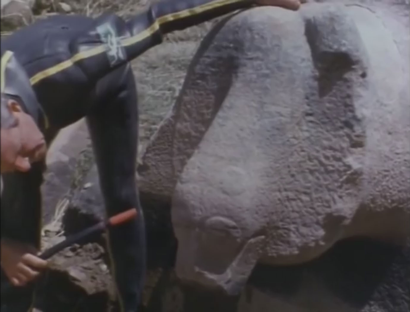
Frédéric Dumas inspects the carving of a specticled cobra on a megalithic block of what is probably grey andesite. Every effort has been made to trace the copyright holders of the material reproduced.
Dumas remarked that to find the representation of a cobra on the shores of Lake Titikaka was quite mysterious and left it at that.xiii That, to say the least, is something of an understatement if we allow ourselves time to reflect on the implications of his find. Cobras are not indigenous to South America and would have found it very difficult to survive in the harsh present-day climate of the altiplano.
Remains of sunken cities in the ‘little lake’ of Wiñay Marka
The French team’s excursions in the mini-submarines did, however, yield some tantalising results. At the southern end of Titikaka, in Wiñay Marka,3 they found yet more interlocking megaliths. In doing so, Cousteau made an explicit comparison polygonal architecture of Sacsayhuayaman.xiv Similarly, in the region of Oré – also in Wiñay Marka – Cousteau’s team found, “….an imposing ruin made of well-joined stones. This structure seems to be the subbasement of a building of some kind – no doubt a temple well known to archaeologists.”xv
Large blocks of grey andesite filmed by the Cousteau team in the shallows of what was probably the Wiñay Marka, known as Titikaka´s ‘little lake’. Every effort has been made to trace the copyright holders of the material reproduced
Although perhaps not fully understood at the time of Cousteau’s expedition, these findings could be highly significant with regard to the the age of the polygonal stone ruins. Wiñay Marka is much shallower than the main part of Titikaka, meaning that it has dried up completely during periods of extreme drought. A recent study of climatic changes undertaken by the Bolivian environmentalist, Edwin Conde Villareal, in which he scrutinised several different surveys of the Andean paleo-climate, came to an interesting conclusion. He found that between about 10,500 and 8,000 BC – a period that corresponds roughly to the Younger Dryas – Wiñay Marka was not a lake at all.xvi Could it be that the megalithic structures found by Cousteau’s team were constructed during the last big freeze of the Ice Age, when the ‘little lake’ had been dry?
Cousteau was ultimately frustrated because of the technical limitations of equipment designed in the 1960s. A subsequent underwater expedition, however, led by the Bolivian archaeologist, writer and filmmaker Hugo Boero Rojo in 1979, was not subject to the same constraints. The Bolivian filmed his underwater explorations and turned them into a documentary entitled, El Lago Sagrado, (the Sacred Lake’). Boero Rojo discovered many cyclopean walls that had largely eluded Cousteau in the main part of the Lake. An article from a La Paz newspaper on the morning of 4th December 1980, which previewed the film’s release, captured the significance of his discoveries:
Monumental blocks of stone that seem to be the walls of half-destroyed temples, paved roads that lose themselves in deep caverns and pathways that penetrate the depths of the Lake have been found.xvii 4
If this description is at all accurate, this was not some isolated temple but an extensive and submerged architectural complex. It is quite mystifying that the results of Boero Rojo’s underwater research are not more widely known or discussed today. Once again, in this age of the internet, one would expect his film to be widely available, but it is not.
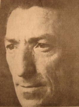
The Bolivian writer, archaeologist and film maker Hugo Boero Rojo (1929-1997). Why is his film, “The Sacred Lake” not more widely available today?
Photograph reproduced with the kind permission of Diccionario Cultural Boliviano (the Dictionary of Bolivian Culture).
In Bolivia, one person has come to dominate how the Pre-Columbian past is seen; Carlos Ponce Sanguinés. Sanguinés has been largely responsible for how many people today understand the ancient Bolivian Andes. For instance, the present-day archaeological site of of Tiwanaku is largely Ponce Sanguinés` personal creation. Early in his career, one of his main interests was underwater archaeology. His investigations around Lake Titikaka mostly focussed on a reef near to the Island of Khoa, where he led a series of expeditions between 1975 and 1991.xviii Throughout, he has been a champion of the relatively recent dating of Andean megalithic sites, relying largely on radiocarbon 14 dating to do so.
At the start of the new millennium, the underwater exploration of Lake Titikaka took a rather interesting if not controversial turn. A scientific expedition named Atahualpa 2000 dived beneath Titikaka’s waters near to the Island of the Sun. The team found submerged agricultural terraces, a retaining wall, a 2,300 feet (700 metres) long pathway, at the side of what may have been a ceremonial centre; all at a depth of some 164 feet (50 metres). An underwater archaeologist with the group, a Brazilian named Dr Soraya Ayub, said that she thought the level of the lake had probably been much lower in ancient times. Indeed, the results were so encouraging, she added, that a further expedition was planned, using robots that would allow them to explore to a depth of around 820 feet (250 metres). The Bolivian archaeologist attached to the Atahualpa 2000 Expedition, Eduardo Pareja – who had previously explored the reef near to Khoa Island with Ponce Sanguinés – emphasised to the media that the ruins discovered by the Expedition dated from around 2,000 BC at the very earliest.xix
For his part, Carlos Ponce Sanguinés was keen to dismiss the Atahualpa 2000 finds. Although not a geologist, he observed around the Island of the Sun many rocks that formed right angles. They could easily be mistaken for parts of walls; but they were most definitely not walls or parts of any other constructions, he told the press. He went on to urge a more ‘scientific’ approach to the investigations. Others, like the Andean historian Teresa Quisbert, considered the finds to be “extremely important” and a vindication of the work of Hugo Boero Rojo.xx
In 2002, the organisation that was the driving force behind Atahualpa 2000, Akakor Geographical Exploring, ventured once again into the Lake for its second expedition; this time giving it the name of Titicaca 2002. The Expedition discovered a number of worked stones nested inside each other. According to a BBC report at the time, one of the Expedition’s members – Gustavo Villavicencio – ruled out the existence of a sunken citadel spoken of in local legends. Rather puzzlingly, the BBC article did not explain how Mr Villavicencio came to hold such counter-intuitive opinion either.xxi Whatever the significance of the nested stone blocks, it certainly did not stop the appearance of newspaper articles about sunken cities. When Akakor Geographical Exploring began its third expedition in 2004, several articles at the time speculated that the 2004 expedition was setting out to to find the submerged fabled city of Huanaco.
The 2004 Akakor Expedition was a joint venture, which enjoyed the support of the Bolivian Navy and the Bolivian National Institute for Archaeology.xxii According to a contemporary press report, they photographed objects at some 262 feet (80 metres) below the surface, thanks to the robotic equipment. This could not only cope with the pressure, but it could work at very low temperatures. The robots were smaller than Cousteau’s ’sea fleas’ and were therefore far less prone to disturb the mud on the Lake´s bottom. One curious finding that received ample press coverage at the time was said to be a sunken island, called La Isla Wilakota, which the press described as the ‘Lake of Blood’.xxiii This was supposedly a place where numerous human sacrifices had taken place. No information was given as to how some Expedition members had come to this conclusion, as there were no reports of human remains being found. The robots also filmed a large golden statue, or idol. This was said to have been extremely heavy and was left where it was, its location kept a secret. This explanation for not recovering the statue is somewhat curious. Remember that the Bolivian Navy was a partner in the project and must have possessed the heavy lifting gear necessary for the task.
A Wall Covered in Gold Lying on Lake Titikaka’s Bed?
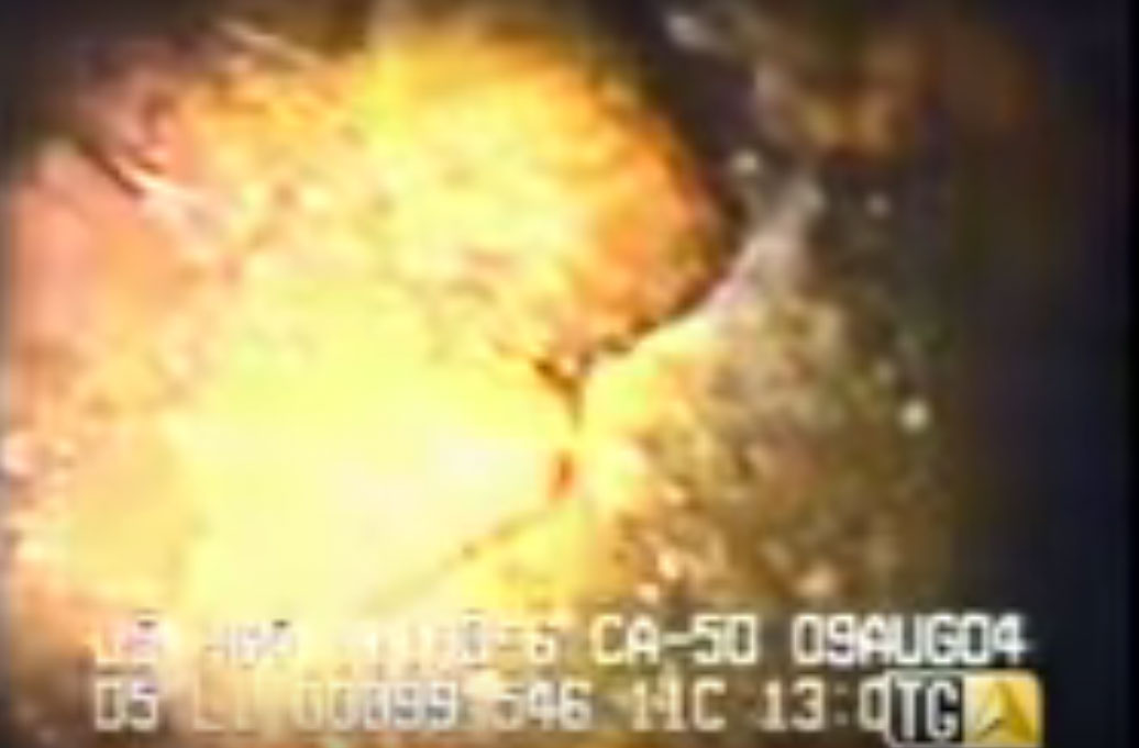
Still from an Italian news programme of 2004, which included interviews with some members of the Akakor Team. The film appears to show a wall that has been clad with gold lying on the bottom of Lake Titikaka.
This image is the intellectual property of Akakor Geographical Exploring, and is licensed under CC by Dave Truman. More images of Akakor Geographical Exploring´s expedition beneath LakeTitikaka can be viewed here.
That explanation, however, pales into insignificance in comparison to Akakor 2004’s most exciting discovery. The Italian and Brazilian members of the team were interviewed for an Italian television news programme, for which they also provided some underwater film footage.xxiv In the part of the interview that addressed their deepest discoveries in the Lake, the film showed what looks like a collapsed wall clad with gold (see above). As far as I know, none of this was reported in Bolivian press – or anywhere else apart from that single Italian news report. Most significantly, the news report mentioned that some Akakor 2004 finds were more than 5,000 years old.
Interestingly, a contemporary Bolivian press report gave two different interpretations of the finds from the Expedition that cannot easily be reconciled. On the one hand, it quotes Eduardo Pareja, who was by then a spokesman for the Bolivian Ministry of Culture. Pareja was keen to emphasise that the finds were relatively recent. He interpreted the gold statue as having been housed in a temple, which still stands in ruins on the Island of the Sun. He chose not to mention anything about the gold-clad wall. Conversely, the same same article reported that the Expedition had discovered evidence for a civilization of between five and ten thousand years old – found at a depth of around 330 feet (100 metres). The article also stated that some members of the Team believed that the Island of the Sun had once been a peninsula. They further considered that the coastline of Lake Titikaka had been radically different in ancient times to today and that this had been partly because of earthquakes.xxv
Why was there such conflicting information in the same report? Why did the foreign members of the Akakor team interpret the evidence differently from Eduardo Pareja? The Akakor team had raised issues that were at odds with what most mainstream archaeologists found comfortable. They had spoken of the possibility of major fluctuations in the levels of the Lake and had implied that there had been earthquakes and floods. In other words, they suggested not only that the remains they had found were far more ancient than conventional archaeology believed, but that the Altiplano had also been subject to catastrophes in the past. This was doubly threatening to the conventional and relatively recent dating of civilisation in the Andes. Although radiocarbon dating can be a very effective, it does have certain limitations and complexities, which I have discussed elsewhere. One factor that renders radiocarbon dating to be most effective is environmental stability over long periods of time. It is at its best where there have been no earthquakes or floods that can disturb and mix up sediments or shift geological strata. This was clearly not so if the catastrophic scenario proposed by some of the Akakor team were true. In short, the threat did not just challenge the recent dating of Andean civilisation, it also called into question the dating methodology itself in the Andean context.
When I began this part of my research, I did not suspect that any archaeological evidence had been actively covered up. Now I am far from sure. In December 2016, I made the trip to the small museum of underwater archaeology on the Island of the Sun. I had visited the museum before, a year or so after it had first opened in 2010. I was keen to study more, and to take more photographs of some of its exhibits. As my investigations progressed, it had gradually dawned on me that some of the exhibits I had seen there were more important than I had first realised. After several hours of scrambling along coastline pathways I arrived at the museum, which is situated beside a stony beach in a bay at the southern end of the Island.5 To my disappointment, I found the museum´s main entrance chained and padlocked. I asked some of the locals about whether the museum would open that day and was advised to consult the leaders of the local community. One particularly helpful man offered to introduce me to the community leaders after he had finished attending to his pigs. I took the opportunity to explain to him about my research and he seemed very interested in much that I told him.
We walked up the steep incline to the village´s plaza and met up with a local community leader. Following negotiations amongst the village elders in Aymara, I was given leave to enter the museum. On entering, I realised that it had changed radically from the place I had visited five years earlier. Gone were the heads of statues retrieved from the Lake, presumably by the Akakor Expedition in 2004. Gone were the exquisitely life-like miniature ceramic sculptures of sea horses, illustrating the Lake´s ancient connections with Pacific marine fauna.6 Above all, gone was the large photographic exhibit – a still from Boero Rojo´s documentary The Sacred Lake – showing a scuba diver who was treading water next to an immense megalithic wall. Those exhibits had been replaced by the obligatory official timeline of pre-Columbian cultures in Bolivia; some photographs of the lake´s fauna, and examples of clothing; and textiles from the period immediately preceding the Incas.
To be fair, the museum was in the latter stages of being refurbished, but I was still struck by the sheer absence of all of the exciting and challenging exhibits I had seen only a few years previously. It did feature, however, some exhibits that were found in the most recent underwater foray into the Lake in 2013. This was the Bolivian-Belgian underwater archaeological project that goes under the name of Wiñay Marka.7 These exhibits consisted of different kinds of votive offerings, some of which were ceramic feline statuettes (see below), as well as small gold-foil artefacts in the shapes of different animals. Even the Wiñay Marka Expedition, however, is not without its share of controversy. I have heard from a reliable and knowledgeable Bolivian source that Wiñay Marka has recently discovered some relief carvings that seem to be very similar to Sumerian depictions of demigods known as the Anunnaki. Curiously, although reported on the web, all links to pages about this find seem to have vanished from the internet.
Feline ceramic votive offering found by the Wiñay Marka Expedition. The existence of so many votive offerings around the Island of the Sun has led some conventional archaeologists to assert that the local underwater archaeology may almost entirely consist of these – and that there are really no ancient remains of submerged buildings of any significance. Votive offerings could equally be evidence that a sacred place beneath the Lake has been venerated for many hundreds, if not thousands, of years. The veneration of felines is connected with one of the most ancient traditions of Andean spiritual and shamanic practice.
©Dave Truman 2017. This image may only be reproduced for educational or informational purposes.
Every time I visit Lake Titikaka, I find more and more western tourists drawn to its shores and islands. Much of its attraction stems from its splendour and mystery. Yet very few, if any of the foreign visitors who flock here in increasing numbers each year, are aware of the sunken civilisations that often lie just a few fathoms away beneath the waters of this sacred Lake. The real question is why we should be denied this knowledge about our ancient past?
1 …….. del que invadió las islas del lago que entonces gobernadas por el Mallku de Chucuito, al que venció.
2 The Younger Dryas is believed to have occurred at the very end of the last Ice Age, when the world was slowly emerging from the Pleistocene glaciation. Although still controversial, some geologists consider that it was caused by a meteorite impact in around 10,900 BC. It resulted in a very sudden lowering of temperatures that lasted for about 1,500 years before a rapid warming occurred, initiating the present Holocene geological era.
3 The Aymara phrase Wiñay Marka translates into English as “The Eternal City”, which strongly suggests a folk memory of a city beneath the Little Lake.
4 Se hallaron monumentales bloques de piedra que parecen ser muros de templos semidesdruidos, caminos enlosados que se pierden en unas cavernas profundas, caminos que se internan en las profundidades del lago.
5 The Island of the Sun does not have any roads, or motor vehicles.
6 These were said to have dated from Tiwanku´s Classical Period, demonstrating that ancient peoples knew that sea horses inhabited the Lake.
7 The Wiñay Marka Expedition has not just explored the ¨Little Lake¨ after which it is named.
i De la Vega, Garcilaso, Comentarios Reales de los Incas, Tome 29, Ediciónes La Republica, Montevideo, 1992, p2180. See also Allen, J M, Atlantis: The Andes Solution, St Martin’s Press, New York, 1999, p99.
iiComentarios Reales de los Incas. p2189.
iiiWaisbard, Simone, Tiahuanaco, Diez Mil Años de Enigmas Incas, Edición Diana, Ciudad de Mexico, 1987, pp59-60.
ivCieza de León, Pedro, Segunda Parte de la Crónica del Perú, Tomo V de la Biblioteca Hispano-Ultramarina, Madrid, 1880, pp18-19.
vTiahuanaco, Diez Mil Años de Enigmas Incas, pp101-102.
viTiahuanaco, Diez Mil Años de Enigmas Incas, p101.
viiTiahuanaco, Diez Mil Años de Enigmas Incas, p95.
viiiTiahuanaco, Diez Mil Años de Enigmas Incas, p100.
ixHancock, Graham, Magicians of the Gods, Crown Books, London, 2015, pp367-378.
xSee: http://www.ancient-mysteries-explained.com/support-files/discoveriesofalfredogamarra.pdf
xiTiahuanaco, Diez Mil Años de Enigmas Incas, p107.
xiiTiahuanaco, Diez Mil Años de Enigmas Incas, p109-110.
xiiiTiahuanaco, Diez Mil Años de Enigmas Incas, p113-114.
xivBoero Rojo, Hugo, Boero Rojo, Sonia, El Imperio del Sol: Titicaca, El Lago Sagrado de los Incas, Tiwanaku, Cusco, Machupicchu, p95, citing Cousteau, Jaques, Galapagos, Titicaca, The Blue Holes, p118.
xvTiticaca, El Lago Sagrado de los Incas, Tiwanaku, Cusco, Machupicchu, p97, citing Galapagos, Titicaca, The Blue Holes, p148.
xvi See: http://www.eldiario.net/noticias/2016/2016_10/nt161009/nacional.php?n=36&-el-lago-menor-del-titicaca-desaparecio-hace-10-mil-anios & http://blogverdebolivia.blogspot.pe/2016/10/el-lago-menor-del-titicaca-desaparecio.html
xvii Lange Loma, Guillermo, El Mensaje del Sol: Eslabón de los Andes, Grupo Editorial Kipus, Cochabamba, Bolivia, 2009, p46.
xviii http://www.equiponaya.com.ar/mundos_andinos/htm/articulos/monica_valentini.htm
xix http://www1.rionegro.com.ar//arch200111/s23g01.html
xx http://wvw.nacion.com/viva/2000/agosto/25/var3.html
xxihttp://news.bbc.co.uk/hi/spanish/science/newsid_2381000/2381007.stm
xxiihttp://www.bajoelagua.com/articulos/reportajes-buceo/949.htm
xxiii http://www.elmundo.es/elmundo/2004/08/23/ciencia/1093219123.html
xxiv See: https://youtu.be/Hz0x1dsleI0
xxvhttp://www.bolpress.net/art.php?Cod=2002082276
Great stuff Mr Hancock – The Serpent head is most significant as it brings it in-line with all Naga cults across the world. This research is so exciting and absolutely frustrating as we may have evidence here of the first great megalithic society that populated this part of the world….after the Ice Age? Could this be older than Gobekli-Tepi? It is so important that people are reminded about the archeological significance of this area which must hold so many secrets waiting to surface. There has to be more focus from the world community to “get to the bottom ” of this. Thank you for another excellent article and sharing the wealth of your research. – troy
Fascinating! Thank you for sharing!
I´m glad you enjoyed it.
A very, very interesting read, Dave. Thank you. Also I find interesting the name of the people, URU. It means city in Sumerian.
Thanks for the information on the Sumerian connection with the name Uru. Do you happen to know the source for the reference? Jim Allen, who has written a couple of books about Atlantis and Bolivia, maintains that “uru” means copper in Sumerian. The word “uru” may be associated with both concepts, which could be highly significant.
URU can be found on the electronic Pensylvania Sumerian Dictionary (Epsd) where it is given as city. It can be broken down to UR and U, the dog and the cover, the cover of the dog. Or (!) it can broken down to U and RU, a cover to impose. Either way it is a city. Perhaps it was also used to refer to the inhabitants, the citizens.
From my own translations, I also link this symbol to the origin of the French word for gold, which is OR. Sumerian phonetics don’t possess the letter ‘o’. It’s replaced by ‘u’. Of course, this comes down to us through Latin aurum, gold. There is definitely a notion of gold in the word URU. To go one step further (and nobody is obliged to follow me there….), I link the word URU, along with its connotation of ‘dog’ and ‘golden’ to Atlantis. But that is another and rather longer story!
You have made some very interesting observations Madeleine. As you mentioned Atlantis, there is also orichaclcum, of course.
The dog, UR, might be Sirius (covering the city), and is to be found on ePSD. U, the cover is there too. UR is a generic term that can also be used for wolf or even a lion according to context and collocations.
‘Uru’ means ‘ city in Tamil (S India) also!
…..and there were connections between the Sumerians and the Harappan culture. There were connections between the Andes and early Sumeria too. Serpent motifs and stepped pyramids are but two common factors to all three cultures, I think.
Great article, thanks for sharing. Ur is also the name of the old Goddess, URU would be the people of Ur. Perhaps?
As far as I’m concerned the Goddess connection is definitely real. One of the names for the river that follows the course of the Sacred Valley in Peru is the Urubamba. I’m not the first to have noticed the correspondences between this valley/river and the Milky Way, especially during December. This is when the MW is visible in the night sky orientated along a 45 deg NW-SE axis; the same as the Urubamba, below. Moving to Egypt, we find that in pre-dynastic and early dynastic Egypt the goddess Nut may have once been connected with the MW, rather than the whole of the night sky. It’s rather too involved to go into here, but there are several mythological parallels between this period of Egyptian pre-history and the early Incas, surprisingly enough.
Urubamba – amba = mother, old Dravidian – pre-Aryan, also found in Africa, including Egypt, with much the same meaning, morphed into Durga-Sakti or as part of Ardhanarisvara (Siva-Sakti union deity) later. In the Judaic context its also mother/father in one, and technically has no consonants (Aleph is not a vowel) – so a fully embodied incarnation of mother-father god/dess. But of course this came after Brahma and Sarasvati became Abraham and Sarai….
Great article.
Wonderful name, Amba. This info would lead me to consider another contraction of Sumerian, BA-AMA-BA, where AMA is indeed the ultimate parent; pure love.
URU, the city, followed by BAMBA, Lithuanian word for navel. Lithuanian language, according to Wikipedia, is the most conservative living Indo-European language, retaining many features of Proto-Indo-European now lost in other Indo-European languages. BAM doesn’t exist in Sumerian, but very possibly results from a contraction of BA (MA, mother Earth or UM, the umbilical cord) BA. BA means below.
A very good article there, Dave.
During my own investigations into other things, you might find it interesting that when Sirius is at its lowest moment during the course of Precession of the Equinoxes, its zenith path passes right over Lake Titicaca.
Thanks for this. I have come across a Sirius connection too, but from a sompletely different source, so I¨d certainly be interested in knowing more about what you have found. A British researcher called Mark Vidler discovered that Sirius passed directly over Tiwanaku in the year 2000. (See my previous article on Graham¨s site). Of itself, this could be just coincidence, but Tiwanaku´s Akapana Pyramid was very much associated with the puma. For the ancient people of this part of the Andes, the puma was a feminine archetype. I couldn´t help but think of Murry Hope and her book, “The Sirius Connection” when I discovered this.
Hi Dave
Mark would be quite incorrect in his findings, as Sirius was last at its lowest moment in 627CE.
I guess the sum of my findings can be found [url=http://grahamhancock.com/phorum/read.php?1,1046082]here[/url] (if the link doesn’t work,just use http://grahamhancock.com/phorum/read.php?1,1046082
Scroll to the last image and the info below that, and if it catches your attention, read the full post, or search Opus Mundialis Rostau @ weebly for the full findings – needs an edit though.
Cheers
Andrew
I will look forward to reading more about your research and your conclusions. Are you familiar with Mark’s work?
No, I don’t think I know about Mark’s work, but I did read your previous article some time back and was quite interested in the Way of Viracocha.
One thing that kind of throws a spanner in the works of all this is Earth’s obliquity, estimated to vary between 22.1 and 24.5 deg (best estimates of course), with it currently being about 23.5 deg. Having this as an estimated 40,000 year cycle means that Sirius could wander a bit for its zenith path at its lowest position according to the horizon.
While my work was mostly about Khufu’s Pyramid, I couldn’t help but notice that the varying depths of the sockets might indicate something to do with this obliquity period, and indicate a band-width circling the Earth that not only takes in Titicaca but also Tiwanaku, and more than likely a little bit wider when Sirius is concerned.
Graham’s book ‘Underworld’ brought me to this site in 2003, and ‘sunken cities’ might be more prevalent than we know.
Thank you for this. Very interesting.
I have read of the “Rise of the Cordillara”, as a difficult and stressful time of rather short duration, aka a catastrophe in itself. I wonder how geologists might go about discovering and verifying such an event.
Certainly in a land as mountaneous and steep as these mountains are, there should be some broken canyons or naturally exposed faulted faces where such evidence could be found. It is my understanding that the Cordillara rose some 10,000 feet.
It might go a long way toward explaining those now empty agricultural terraces behind the city. And, has anyone found food crop seeds in those beds, or has dirt ben tested for food crop chemical remains?
A sad fate we have, that the truly enlightened must cope with those who are morally bankrupt and seek only for self gratification. Better safe than sorry, but then educating becomes that much more difficult.
Thanks again!
A little while ago I read “When the Earth Nearly Died” by Allan and Delair, whose research indicated that the Cordilleras did indeed rise extremely rapidly in the very same geological period. Others, whose knowledge and expertise in geology is far greater than mine have expressed similar views in personal correspondence. The key question is the paradigm within which geologists are educated. If university’s curriculum is steeped in uniformatarianism, as many are, then catastrophes are unlikely to play any part in what a geologist may learn.
Graham Hancock does such great work!
Very very interesting!! If only we could see the relics, wish that documentary was still around, loved Jacques Cousteau’s under sea exploration documentaries as a child and spiritually it is known, that there is a Light City over Lake Titicaca. Sounds like the city under the lake, before being submerged, may have housed survivors of Atlantis’s final destruction? Thank you Dave Truman for sharing! ❇?❇
Thank you.
Great read, but I have one query and that is about the sold called carved Cobra stones, To me it looks more like a python, anaconda specifically, you can see that the carving is into a snakes body, head at the bottom body at the top. It would make more sense as it is in Sth America, Boliva is known for it’s jungle creatures. And there is a recurring theme with snake divination in all ancient cultures from Aust Aboriginal to Inca & Myan.
I understand what you are driving at and the similar questions occurred to me.However, look very carefully at the back of the snake’s head, You will a very worn, but carved, circle. This I took to be indicative of a spectacled cobra – more than the apparent hood. Having daid this, I do acknowledge that snakes feature prominently in Andean mythology, amongst the Urus, the Pukara culture and the Inca.
Frederick Dumas, respectfully, sorry your wrong, definitely a python/anaconda. I’ve seen doco’s where they have been caught in exactly the same type of read beds.
Well done, Dave, I’m using this as a source for my updated version of ‘Sunken Realms.’
Thanks Karen.
Interesting that Uru is a middle eastern word. Mallku (as in “the islands of the lake that then used to be governed by Mallku de Chucuito”) is an Aramaic word meaning king, ie. one who governs.
Yes, these words do seem to crop up on the Altiplano and around Titikaka. The possible Middle Eastern provenance of the word Mallku was studied by the Bolivian scholar Mario Montaño Aragon. He argued that the word was cognate with the Semitic root MLK, which is the origin of such words as Malkut (kingdom – Hebrew/Aramaic) and Malik (Arabic). I think we need to be cautious when looking at linguistic connections across continents and not just take the meanings of words and their pronunciation at face value, without using other criteria to determine possible connections.