


Caught in that sensual music all neglect
Monuments of unageing intellect.
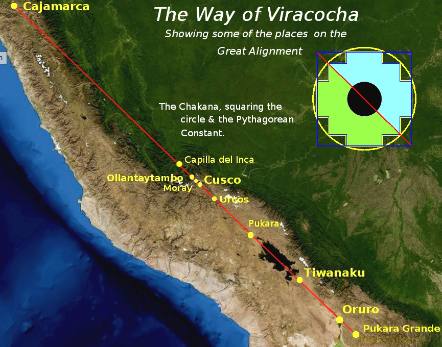
In the 1970s the Dutch-Peruvian mathematician, Maria Sholten D’Ebneth wrote a book in which she claimed to have discovered, or rediscovered, an alignment of pre-Columbian sacred sites stretching from the ancient city of Tiwanaku (Tiahuanaco) in Bolivia to north of the city of Cajamarca in northern Peru. The alignment appeared to be on a celestial scale and covered a distance of around 1,000 miles (1,600 km), cutting across some of the highest mountains and steepest gradients in the entire world. The mathematician found that the alignment had a precise orientation of exactly 45° west from True North, following the twin parallel lines of the Andean peaks that lie to the north of the 18th parallel.
Published only in Spanish, and now out of print even in that language, Sholten D’Ebneth’s, La Ruta de Wiracocha (The Way of Viracocha)i contains a wealth of information hardly known to the English-speaking world. The alignment’s association with Viracocha, the great Andean creator god, teacher and civiliser of humankind, is a highly significant one. Many legends concerning the feats of Viracocha speak of his undertaking a journey, from the city of Tiwanaku towards the Northwest, eventually to leave the shores of South America’s Pacific coast around the present day border between Peru and Ecuador. Viracocha’s legendary journey, Sholten D’Ebneth revealed, corresponded with her own geometrical discovery of the alignment of many of the most ancient and sacred sites in the Andes, including the famous ones at Cusco (Cuzco), Ollantaytambo and, of course, the great and mysterious complex of Tiwanaku (Tiahuanaco).
Andean landscape and geometry
The many megalithic sites along the Way of Viracocha have long given rise to theories and speculations about who built them and to controversies about when they were built. At this juncture, it is perhaps worth pondering the sheer technical challenge of surveying this vast alignment across some of the most rugged, remote and mountainous terrain on earth. Indeed, my own research and that of others, indicate that the alignment could extend beyond Tiwanaku.
When I plotted the Route of Viracocha, I had the benefit of using software such as Google Earth® and Marble. These programs enabled me to employ a spherical projection of the whole globe, rather than the “flat” Mercator Projection apparently used in previous decades. As we will see later, using this map projection yielded rather different results from those of some earlier researchers. This became evident when I extended Sholten D’Ebneth’s alignment beyond Tiwanaku towards the Southeast. If my findings are correct, it implies that whoever surveyed the Way of Viracocha, not only had an understanding of the earth’s curvature, but also understood the principles of spherical trigonometry.ii It is equally likely that those who undertook this work knew the dimensions of the Earth. The question then arose in my mind: could it be that Viracocha, the great teacher and restorer of civilisation in the Andes, in some way embodied the scientific knowledge of a sophisticated, but long forgotten high culture?
Some geological considerations
Another curiosity struck me as I pondered various maps of South America. The very topography of the Andes seems to coincide with the 45° geometry of Sholten D’Ebneth’s rediscovery. It is almost as if whoever first conceived of the alignment had wanted to emphasise the 45° NW orientation of the stupendous panorama of summits and high plateaux that lie to the north of the Andean 18th parallel. At the southern end of the great alignment, the direction of the two chains of rugged peaks changes dramatically. This is the Andes’ widest point and, from following a diagonal from northwest to southeast, the mountains veer sharply due south. This latitude – almost exactly 18° south of the Equator – marks the northernmost edge of what is known as El Cono Sur; South America’s great continental cone that tapers southwards towards Antarctica.
South of the 18° latitude the chemical composition of the high plateau, or altiplano separating the parallel chains of mountains, is extremely salty. Southern Bolivia’s mountain plateau is speckled with saline lakes and salt flats that stretch down as far as the provinces of Salta and Córdoba in northern Argentina. They are the lingering and still evaporating vestiges of the vast Lake Tauca that had once covered the entire length of the Andean plateau at the end of the last Ice Age. Geological convention has it that the lakes and salt flats are simply the remnants of glaciers that melted gradually in the transition to our modern era, known to geologists as the Holocene. However, glacier melt-water alone cannot explain the presence of such high levels of salt on the altiplano’s southernmost reaches.
The marked differences in the concentrations of salt present in the various pockets of water on the Andes also interested the great Austrian-Bolivian researcher Arthur Posnansky. He spent almost fifty years systematically studying the geology and archaeology of Tiwanaku and its surrounding landscape. He took samples from numerous lakes on the altiplano and compared them with the waters trapped in the lakes of the high peaks, or Cordilleras, running along either side. Curiously, he found that the water from lakes in the higher mountains generally contained relatively little salt, whereas many of those from the Altiplano below had much higher concentrations. Posnansky came to the view that there had been several floods at the end of the last Ice Age in the Andes. Perhaps most significantly, he concluded that the earlier inundations had been of seawater; followed later by fresh water floods when the glaciers melted some time afterwards.iii
As we shall see later, further clues as to what really happened at the end of the last Ice Age may be found in the legends of the Aymará people living in the remote villages dotted around the southern altiplano in the Bolivian province of Oruro. Of course, in order to accept these legends as evidence, we must first accept that there has been some degree of cultural continuity between some 12,800 years ago and the present time. Intriguingly, some Aymará legends tell of a far more catastrophic and complex sequence of events in those remote times than the slow and steady melting of glaciers. A deeper understanding of such legends could help us to fathom why there is just so much salt present on one of the world’s highest mountain plateaux, at around two and a half miles (4 kilometres) above the level of the neighbouring Pacific Ocean.

Photograph of one of Posnansky’s excavations at the Kalasasaya, Tiwanaku. Although there is a retaining wall between the megaliths, its height reaches only to the level of the ground. Note also the regular and shallow indentations on the side of the nearest megalith, which may indicate the use of a stone-softening technology.
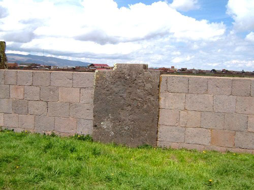
Modern reconstruction of part of the Kalasasaya, with its retaining wall almost equal to the height of the megalith. Note the tenon at the top of the megalith; similar features are present on most of the others. Do these indicate that the Kalasasaya’s megaliths once supported another structure, perhaps a roof?
The minds of Ice Age people: “primitive,” or just very different from our own?
The possibility that people in the Andes as far back as the last Ice Age were skilled in surveying, knew the dimensions of the Earth and could employ spherical trigonometry is intriguing enough in itself. For me, it raises questions as to whether humanity’s existence in the Pleistocene (Ice Age) really did consist exclusively of small very isolated bands of hunter-gatherers who were clinging on for dear life against all odds, and who developed sophisticated achievements only after the slow and steady transition to warmer times. The standard view of human endeavours in this period allows no time or inclination on the part of our ancestors to cultivate what we may now think of as higher learning. Still less does it admit to the possibility that people could travel long distances around the world, conceive of complex ideas collectively, or undertake projects on a vast scale. What if life in most of the last Ice Age, at least for some people, was very different from what we’ve been led to think? There is now mounting geological evidence of two catastrophic punctuations at the very end of the last period glaciation. These were on such a scale that they could quite easily have obliterated most of any human achievements that may have existed prior to their impact.
Yet the question remained as to why anyone should even want to exert so much effort and energy in constructing megalithic sites that aligned over such a vast distance. If this was higher learning, it was not produced by anything like our modern western education system – that is for certain. I am starting to realise that we in the modern West invariably stick our own cultural labels of “religion,” “progress,” “function,” “survival” or of whatever else on to the remnants of the past in order to fashion ancient peoples into our own image. We have almost no idea if our Pleistocene ancestors thought the way we do, but we readily assume this to be the case. I started to realise just how much their minds may have been different from ours when I considered the geometry of the Way of Viracocha. What is distinct about this great alignment is that its features correspond, geometrically speaking, to those of its mountainous environment. Equally, as we have just seen, it displays a close relationship to the orientation of the Andes lying to the north of the 18th parallel.
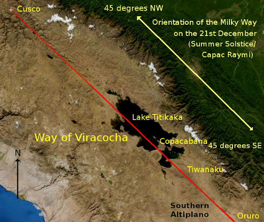
I found another clue to this different mode of thinking when I noticed how the Milky Way seems to shift its position across the sky throughout the Andean year from our earthly perspective. Put simply, the great celestial river is not fixed rigidly in the heavens; its angle and position appear to change, as and when the Earth’s seasons down below do. In the season culminating in the December southern summer solstice, the Galaxy traces the exact same NW-SE path through the heavens as does the Way of Viracocha and, of course, as do the Andes. Without doubt, the December solstice was an important time in the high mountains and plateaux, marking as it did – and still does – the cardinal point of the rainy season. This was so necessary for the growth of crops and the stimulation of new life. We would be mistaken, however, if we confined our thoughts about this deliberate synchronisation of Heaven and Earth to agriculture alone. The sheer effort involved in constructing the Way of Viracocha, which must have been undertaken over many years, argues strongly against this. At this stage in my investigation, I needed to keep in mind questions as to why these people should have made all of this effort, as much as to how they had set about the task.
It seemed that the Hermetic dictum of As Above, So Below applied equally to the world-view of those who conceived of this great enterprise as it did in Egypt, Arizona, Southeast Asia, or in a plethora of other places across the world. There are, in fact, tangible relics that attest to the ancient Andean shaman-astronomers’ profound understanding of the symmetry of Heaven and Earth, but they are rarely recognised as such by the adherents of conventional archaeology. The builders of ancient Tiwanaku employed an architectural convention known as anticefalo (literally “head against head”). You would be hard put to find examples of this if you visit its ruins today, but specimens do exist in the Archaeological Museum in the city of La Paz. Anticefalos usually depict a stylised relief carving of a human form on the bottom part of a stone column. Immediately above this is carved an identical figure, but inverted. The net result is a kind of mirror image of the human form, so that the tops of the heads of the two figures create the meeting point between them. The standard archaeological interpretation is that this is merely a stylistic device, but I think that it encodes a profound metaphysical principle.

Posnansky’s photograph of a damaged column showing the anticefalo motif.
Other physical relics of this ancient appreciation of the symmetry of Heaven and Earth are what I call watery star-mirrors, for want of a better term, which were used from the very earliest of times. They consisted of holes, or receptacles, that were filled with water to create a mirror image of the heavens on the water’s surface. If you are lucky enough to visit an archaeological site in the Andes possessing any of these, your tour guide will probably tell you that they were used by the ancient peoples to gaze at the stars. He or she will then promptly usher you on to look at something else. The guide’s explanation, although technically accurate, is hardly adequate and makes little sense without any cultural or functional context. In the view of the Peruvian architect and archaeo-astronomer, Carlos Millena Villena, aquatic star-mirrors were devices that enabled the Andean knowledge-keepers, known as amautas, to construct temples, geoglyphs and other sacred places in the most auspicious locations, through replicating on the earth’s surface the geometry of particular asterisms.iv They also seem to have been a technology of time as much as of astro-terrestrial geometry in that the mirrors were located facing upwards in such a way as to reflect the light of particular stars, such as Sirius, Alcyon, or the Sun, on significant dates.v
By far, most of the vast complex of Tiwanaku, which includes ruins beneath present-day Lake Titikaka – more than 12 miles (20km) from the restored part of the Metropolis – has yet to be excavated (in the 1980s, an aerial survey estimated that the ruins of the complex not currently beneath the waters of the Lake covered some 1,038 acres, or 420 hectares).vi Tiwanaku’s most recent excavations, in the little-known area called the Kantatallita, have revealed a number of immense stone slabs that look to have been cut precisely by machine tools. The workings on the face of the slabs include an array of several round and rectangular shaped recesses, which probably functioned as star-mirrors. There is no doubt that in later times the Incas used star-mirrors, but the technology was certainly employed by much earlier Andean cultures, including the unknown one that occupied the very ancient site of Pukara Grande in southern Bolivia, which features towards the end of this article.

Star-mirror at Pukara Grande, southern Bolivia
Although its flat summit has now been scooped out by treasure hunters, Tiwanaku’s Akapana Pyramid was once the location of a large star-mirror that took the form of an Andean cross, or chakana (see below for an explanation of the significance of the chakana’s geometry). It is not beyond the bounds of reason to wonder if this, and the other star-mirrors of Tiwanaku, were used to gauge when the Milky Way overhead reached an angle of 45°, when it would have aligned with the Cordilleras that stand on each side of the great Andean Metropolis. As we know, the solstice was an important time of the year in terms of material well being, but that was just the reflection on the surface of a wider and deeper cosmological meaning. Before we examine the mirroring of the Milky Way further, it is worth mentioning a curious but related fact. The British researcher Mark Vidlervii discovered that during our present era, the heavens’ brightest star Sirius passes directly over Tiwanaku along its path in the heavens running from east to west. This could be dismissed as arbitrary and coincidental, were it not for the timing of this celestial event – at the halfway point of a precessional cycle of 25,920 years from the ending of the last Ice Age. I cannot help but wonder if those who originally surveyed and established Tiwanaku’s location were trying to tell us something about the rhythms of cataclysmic change on Earth and in the Solar System.
Again, the question arises as to why the amautas of the Andes would go to the trouble of creating star-mirrors just to study the heavens, when they could simply have looked upwards in order to do so? As we have just seen, placing star-mirrors in specific positions would have helped them to determine the timing of certain key events, but there must have been other reasons for this practice. Staring at reflective objects – such as crystal balls – for long periods of time in something known as scrying, can induce a form of autohypnosis. The fact that these watery mirrors constantly reflected the stars and planets above, by virtue of their being placed face-upwards, perhaps hints that they were used for a sophisticated form of scrying. The emerging findings of my research have led me to the view that the ancient shamans of Tiwanaku took this process a step further than this, even. In effect, star-mirrors were a kind of astro-shamanic technology that enabled human consciousness to journey beyond its physical bounds under certain special conditions.
The notion that consciousness can leave the body may seem fanciful, perhaps even preposterous, to our western post-enlightenment culture, but it is entirely consistent with how shamans believe they work. They often maintain that the non-physical world through which they journey is a mirror-image of the material one; an idea that seems to have extremely ancient roots.viii Interestingly, some modern tribal peoples, such as the Hopi of the southwestern United States, still adhere to this kind of symmetrical cosmology.ix Our contemporary western conception of the world is generally set at odds with such ideas, but they were meat and drink to those who constructed the Way of Viracocha. Indeed, these notions seem to have retained a power in the minds of those who used star-mirrors in all of the successor cultures down to the time of the Incas. For this reason alone, we should consider them with respect at the very least. Without doing so, we in the modern world cannot appreciate – let alone fully understand – the magnificence of ancient cultures beyond the bones, stones and pottery shards that they left behind them before departing to the stars.
Where the river of stars meets the wheel of time
We come now to what was probably an essential aspect of the 45° alignment, if not what all of the immense effort was principally in aid of. That the most ancient peoples, including those of the Andes, considered the soul to be immortal is something that may be thought of today as a primitive trait, especially if our values conform to the modern western materialist milieu of linear progress. For ancient peoples, however, the soul’s departure to the heavens after death was not some fable, or even a vague aspiration. Rather, it was a technical process that was associated with the Sun’s passage along the ecliptic to where it crossed the celestial river of the Milky Way. This was the heavenly spot where departed souls arrived at the junction between the realms of time (the ecliptic) and eternity (the Milky Way). Conversely, the same place was where returning discarnate souls entered into the realm of mutability and change, by re-joining the circular path of the ecliptic that marks the various cycles of time in the physical world. The solstices – as points along the annual path of the sun when it appears to stand still for a while – provided the gateways for the soul to pass between the world above to that below and vice-versa.x
Some of the cosmology dating from the end of the Ice Age lived on in the traditions and mythology of the peoples of South America, as much as it did in other parts of the world. The Incas were a significantly more recent dynasty of shaman-astronomers, but ultimately they drew on lore from those far-off times. For example, they both adopted and adapted the very ancient concept of animal “star guardians,”1 that probably originated at the end of the Pleistocene era.xi (An age-old Andean tradition associated each star guardian with a particular tribal lineage, which much later was duly incorporated into the Incas’ system of state governance). In furthering our understanding of the Way of Viracocha, we need to view the Incas’ December solstice festival of Capac Raymi in a similar manner. As well as marking the birth of the Sun in the Incas’ solar year,2 Capac Raymi was a time when the souls of the dead were thought to return to the earth in order to reaffirm their tribal and cultural identity with those living down here. The latter reciprocated by providing a lavish feast over four days, during which they partook heartily alongside their ancestors.xii It seems that, in the festivities of Capac Raymi, the Incas had maintained the cosmology of the solstice gateways as transition points between the physical and supernal worlds.
More than anything, I consider the existence of fragments of this cosmology in the mythologies, customs and lore of many diverse cultures from around the world to be testimony to the extreme antiquity of a sophisticated world-view. Although it is beyond the scope of this article, I am increasingly of the opinion that this venerable cosmology also included the existence of spatial dimensions beyond the three that we normally think of in our modern material world. (The aether of some Greek modes of thought and the akasha of the proto-Hindu Vedic culture are two examples of such vestiges). The relationship between the physical world and these higher dimensions is, as the physicist Paul La Violette has noted, a dynamic one;xiii but there were also analogues between them. These were almost certainly expressed in terms of geometry and number. In a way that modern minds generally fail to grasp, our remote ancestors were attuned to these analogues. That the Way of Viracocha is set at an angle of 45° corresponding to the Milky Way’s orientation above the Andes at the December solstice should be seen as highly significant in this respect.
The chakana, sacred number and geometry
The striking nature of this analogous way of thinking can be found in Sholten D’Ebneth’s discovery of the connection between the Way of Viracocha and the geometry of an ancient South American sacred symbol, called the chakana.
Certain symbols seem to defy the changes brought about by time and the ebb and flow of history. In South America, one such symbol is the chakana. Otherwise known as the Andean stepped cross, it has been found in the relics of so many of the varied pre-Columbian cultures of South America. In one form or another, you will find it in the Mapuche art work in the south, on the enigmatic stone blocks of Puma Punku, on the embroideries of the Incas, adorning the adobe walls of the city of Chan Chan and woven into the textiles of the war-like Huari culture. It has been found in the ancient pyramid city of Caral, which dates to around 4,000 BC, where it embellishes the joists of the Ceremonial Centre. The Inca Cross is yet another name for it, but its provenance as a symbol is much more ancient. As with other symbols of great antiquity, the multiple meanings associated with the chakana are the result of accretions over time.
Even today, you can see chakanas throughout South America, not just in the Andean region. I have even seen chakanas adorning the belt buckles of maté drinking gauchos in the Rio Grande do Sul in Brazil. In the Andes you will see the chakana everywhere: from rainbow coloured flags fluttering in the Plazas de Armas, to painted signs advertising restaurants and hotels. There is little space this in article to do justice to the multiplicity of interconnected meanings and correspondences associated with the chakana in contemporary Andean life and culture. These are usually summarised in the phrase ‘Andean Cosmovision’ and readers interested in the manifold aspects of the chakana are encouraged to search the Internet to learn more.
If we take the liberty for the moment of cutting through the complex meanings associated with chakana, we find at its heart a code of number and geometry from which all of its later associations grew. Astonishingly, these numbers appear to bear striking parallels with those found in ancient myths and sacred texts from all around the world. What is more, both the numbers and geometry of the chakana are found encoded in ancient architecture, much of it sacred, in many locations worldwide. An even greater mystery is that certain numbers also seem to be encoded in the fabric of nature itself. Are we seeing here, not just the traces of an ancient, universal and sophisticated body of knowledge, but also a code that could tell us about the nature of the world in which we live? Perhaps there is something here that our current reductionist and materialist scientific consensus has missed, because it does not possess the concepts to acknowledge its existence.
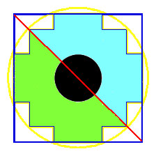
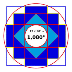
Let us now examine just a small part of the chakana’s number and geometry in order to provide some evidence of the above contentions. To draw the chakana geometrically, we start by dividing a square in two diagonally, and then circumscribing it (i.e. drawing a circle around the four corners of the square). The stepped cross of the chakana is then constructed within the space that has been outlined.
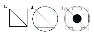
In classical Euclidean geometry, this process is known as ‘squaring the circle’ and was a fundamental task set for students of the discipline. In sacred geometry and alchemy, the square and the circle are thought to represent opposite principles – the square being masculine and the circle feminine. However, they are equal in that both consist of 360°. In esoteric terms, the act of squaring the circle equates with the unifying of masculine and feminine principles at work in the universe. Interestingly, a Peruvian researcher into the Way of Viracocha, Javier Lajo, found that many ancient sites and temples along its length had either square or circular geometry, depending on whether they were dedicated to male or female deities.xiv
However, there is more to the process of drawing the chakana in the manner described above. It also involves drawing a 45° diagonal line across the square. (If you are sensing a certain familiarity with the geometry of the Way of Viracocha here, you are starting to appreciate the analogous way of thinking discussed above). The cutting of the square in this way produces a diagonal with a value equal to something called the Pythagorean Constant, which equates to the square root of two. (That Pythagoras’ teachings, including those on number and geometry, were rooted in archaic shamanism is little understood todayxv). The ancient Egyptians used exactly this geometric operation to derive the linear units of measurement of both the Royal Cubit and Remen.xvi Interestingly, there appears to be a connection between this geometry, and not only in ancient Egypt, but also in the measurement system used at the Akapana Pyramid in Tiwanaku.xvii A further example of this geometry is seen in the traditional Andean flag, called the wiphala, which takes the form of a square divided diagonally.
Pythagorean Constant A square with sides of one unit long will always produce a diagonal with a length equal to √2; an irrational number, the first few decimal places of which are: 1.414213562
Wipala One of the four flags of the constituent parts of the Tawantinsuyo (Four Parts Together) of the Incas. Much of the Incas’ symbolism was based on very ancient prototypes.
The modern mind is accustomed to think of numbers solely as a means of defining quantities, but the ancients saw things differently. For them, particular numbers, and their multiples, also expressed certain qualities. Thus, odd numbers were considered masculine and even ones feminine, for example. There is one particular series of numbers that seems to recur in many sacred texts, which has been identified by several researchers in various fields of study. This set of numbers, or some of its members, occur in ancient systems for measuring time, in the dimensions of sacred buildings and numerous other contexts. They include the numbers 36, 72, 108, 144, 216, 288, 432, 504 and their multiples both by 2 and 10. These numbers are certainly redolent of the great cycle of precession,xviii but they equally characterise, “a World-Image that fits the many levels”xix present in these ancient systems of thought.
There is one particular number from this series that seems to be associated with the geometry of the chakana. In the form pictured in this article, the chakana contains 12 x 90° internal angles. Multiply these numbers together and we get a product of 1,080°. Multiples of this number occur frequently in the years, both human and divine, attributed to several of the Yugas in Vedic cosmology. In Gnosticism, 1,080 was said to represent the Divne Feminine and the Serpent of Wisdom.xx In Japan, Shinto priests strike the temple bell 108 times to herald the New Year, indicating the end of one cycle and the beginning of another. Even more than this, the number 108 seems to be encoded within certain measurements we use today to quantify the physical universe. The atomic weight of silver is 108 (traditionally considered a feminine metal) and the radius of the moon (alchemically and astrologically associated with silver) has been estimated to be 1,080 miles.
The Sumerian connection
Of course, the sceptic may argue that I am simply playing with numbers and that all of this assumes that people in the ancient Andes would have had to divide the circle into 360° in order to obtain the number 1,080. The latter proposition is not so ridiculous as it may appear at first sight. The 360° circle was, we are told, a Sumerian innovation and there is evidence that it may have been applied in very early times to surveyingxxi and navigation.xxii As for connections between ancient Sumeria and the Andes – there are at least two curious artefacts discovered on the altiplano, not far from Tiwanaku, which suggest just that.xxiii One of them is exhibited in the Museum of Minerals in La Paz and is called the Fuente Magna. It is a ceramic bowl that has cuneiform writing on part of its inside surface, which has been identified as proto-Sumerian, probably dating to a little before 3,000 BC. The other is known as the Pokotia Monolith and consists of a statue of a human form, nearly 4ft (120 centimetres) tall, on the front of which is what also appears to be proto-Sumerian cuneiform writing. Conventional archaeological wisdom writes-off these objects as fakes. (If so, then the forgers went to a lot of trouble to concoct linkages between the relatively obscure proto-Sumerians and the equally little-known Pukara culture that preceded the classic Tiwanaku period in the standard chronology).
These objects are not alone in suggesting a link between ancient Sumeria and the Bolivian altiplano. My own research indicates parallels between the design of Tiwanaku’s Akapana Pyramid and Mesopotamian ziggurats, which interestingly enough, are thought to have been originally constructed as shamanic devices.xxiv The Akapana had, as we have seen, a watery reservoir or star-mirror at the summit – a feature that it shared in common with the ziggurats of Mesopotamia. Both the Akapana and ziggurats consisted of seven steps. In Mesopotamia, each step corresponded to one of the seven Sumerian “planets”. It has long been believed that the ancient Andean star-gazers had no knowledge of the movements of planets. However, contrary to the academic consensus, there is compelling primary evidence from at least two different Spanish chroniclers that the seven “planets” were well known. Astoundingly, each was associated with a “god” who possessed precisely the same qualities and attributes as its Mesopotamian counterpart.xxv One of the functions of ziggurats was to enable the surveying of the Earth’s surface in such a way as to produce an accurate flat map projection from its curvature.xxvi There is a compelling hint that the Akapana may have functioned in a similar manner to this, placed as it was along the Way of Viracocha. Arthur Posnansky, who we met earlier, noted that the Pyramid’s name might be derived from the archaic Aymará phrase, Aka–Kjahuana – meaning, “the (important) place from which one spies, or looks.”xxvii
All of this indicates that there was probably contact and the sharing of technical knowledge between ancient cultures in the Andes and those in the Middle East. If so, this occurred much later than the end of the last Ice Age. To my mind, it raises the intriguing possibility that there has been a whole series of contacts between the Andes and other cultures over many thousands of years. If the Fuente Magna and the Pokotia Monolith are genuine, and my observations concerning the Akapana are not delusions, these contacts took place in an era that corresponded to the establishment of Sumeria and the first Egyptian dynasties. However, this may have been one of the last contacts to take place across the ocean in the ancient world.
The question of cultural contact at this time raises the thorny dichotomy between diffusionism and isolationism, the latter being the current academic dogma. Again, the modern way of thinking likes to stick labels to everything, as if it needs the mental security of giving something a simple name and a simple narrative. Might our real history be rather more complex and consist of periods when civilisations existed in relative isolation and yet others when travel and the sharing of knowledge was more common? This would certainly be consistent with an Earth that has been subjected to a series of catastrophic events, which would now appear to be the case – even since the end of the last Ice Age. This scenario might also provide a plausible context for a motif that occurs time and again in the world’s mythologies; that of the great teacher and civiliser of humankind, who establishes, or restores, order after a period of chaos. This brings us very neatly back to Viracocha, whose Way is the South American expression of this universal mythos.
Megalithic structures: relics of an ancient high culture?
It is no coincidence that many of the megalithic sites identified by Sholten D’Ebneth along the Way of Viracocha appear to be extremely ancient. Of course, this view is anathema to academically trained archaeologists, who see the development of culture in the Andes as a matter of slow and steady progress. In their scenario, none of the megalithic structures are much older than about 1,500BC (Tiwanaku/Puma Punku), and many of them, which they consider to have been built by the Incas (Cusco, Ollantaytambo), are considered much more recent still.
There is some evidence to support the extreme antiquity of Andean civilisation in the legends of the indigenous peoples. Many of them mention a time in the distant past, when there was a great civilisation of demi-gods, called the Ñapac Machula (The Wise Old Ones),xxviii elsewhere called the Viracochas. Other legends speak of the destruction of the ancient civilisation by a great flood called the Uñu Pachakuti, which swept down the altiplano from the north, obliterating everything in its path. In some legends, Viracocha himself is portrayed as the one who restored the gifts of civilisation to humanity after he had destroyed his first creation in the Uñu Pachakuti.xxix Very little of this information is valued by academic archaeologists.
Feats of engineering that defy the conventional explanations
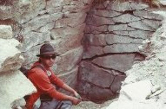
Let us now take a brief look at what the construction of just one of the megalithic sites on the Way of Viracocha involved. Ollantaytambo lies in the Sacred Valley of the Incas to the northwest of Cusco. Its megalithic blocks are fashioned from a particularly hard stone called rose rhyolite and they weigh up to 50 tons (45,500 kg) each. There is even one stone that is estimated to weigh some 250 tons, lying at the bottom of the Urubamba River, which runs along the Sacred Valley.xxx
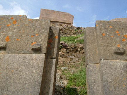
A massive block of rose rhyolite appears suspended above precisely worked blocks of andesite at the edge of the Temple of the Sun at Ollantaytambo
It is worth considering the practicalities of this feat of construction, because stones this large would be extremely difficult to move and position today, even with modern hydraulic equipment. Now consider that these megaliths probably came from a quarry on the opposite side of the Sacred Valley, some 200 feet below the level of the construction itself, but requiring a 3,000-foot climb up the far side of the Valley just to reach them. Remember too that all of the stones had to be moved and positioned at an altitude of 9,160 feet (2,792 metres) above sea level, where there is a dearth of oxygen. When I first visited Ollantaytambo, I was left gasping and dizzy in my attempt to reach the top of its immense terraces, because I was not then accustomed to the altitude (some people never do acclimatise to it). The debilitating effect on muscular strength at high altitudes should not be underestimated, but it is hardly ever taken into account by conventional explanations of how this cyclopean structure ever could have been built in the high Andes. Consider also that the work was carried out in some of the most rugged terrain on earth, with the steepest of gradients and apparently without the use of any horses or pack animals other than llamas, perhaps.
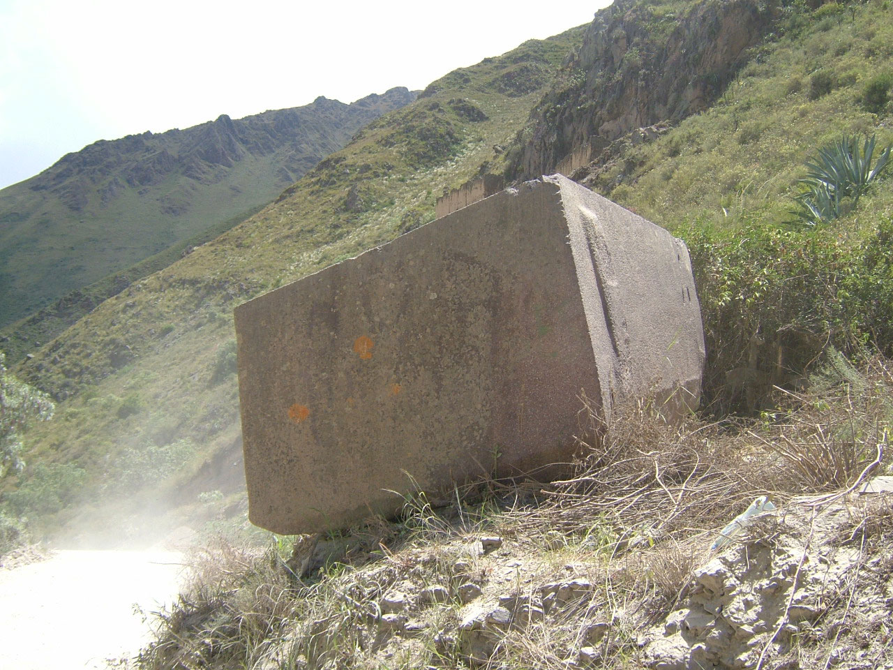
One of several massive blocks of rhyolite that were apparently left abandoned in the Sacred Valley between the quarry and the Temple of the Sun, at Ollantaytambo.
Hints of a technology about which we know next to nothing
It is not just the size and scale of many of these constructions that defy conventional explanations; there is also the fact that some stones have been cut with such precision that one has to question what their original purpose may have been. The engineer Chris Dunn has remarked that the degree of precision of these stones is way beyond what would be needed for building purposes.xxxi
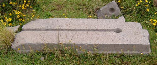
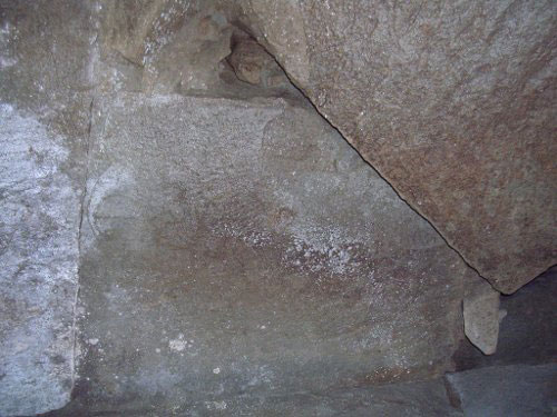
One of many precisely cut pieces of grey andesite lying abandoned amongst the ruins at Tiwanaku.
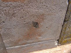
There is one type of stone in particular that seems to have been used in this way; a stone called grey andesite. Invariably, it is grey andesite that is cut to the most precise angles, has the flattest planes, and which often has finely and regularly drilled holes. At Tiwanaku and neighbouring Puma Punku, you can find precisely cut blocks of it in abundance, scattered in a desultory manner amongst the ruins of this enigmatic complex. A few of the grey andesite blocks here have chakanas carved on to them. It was during a visit to Puma Punku at the end of 2012, that I discovered a curious fact about these particular stones. When a compass was moved across the carving of the chakana, the direction of the magnetic field changed; most often this was to an orientation of 45°NW.
The following year, I returned and tried the same test on two larger blocks of grey andesite marked with chakanas at a place called Kantatallita, (which also has the star-mirrors referred to earlier, and a pyramid buried deep in alluvial mud). Again, I got a similar result when I moved the compass across the face of the chakanas. However, this time I noticed another effect. The distortion in the magnetic field appeared to be a lot stronger on the left-hand side of one of the carvings, with the compass reading settling rapidly at 45°NW off magnetic north, but it did so considerably more slowly on the right-hand side of the carving.
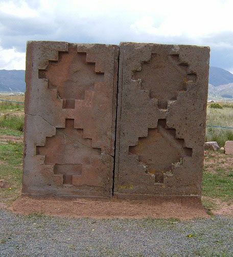
The two large blocks of andesite at Kantatallita Tiwanaku featuring chakanas carved into their surface. When I moved a compass across the chakana carved into each block, the reading on the compass needle changed.
I decided to explore the rear side of the stone block. Directly behind the left side of the carved chakana was a small diamond-shaped piece of black stone, which I can only presume to have been magnetite, embedded within the block of andesite. When I passed the compass along the back of the stone for the first time, it gave a normal reading until it reached the black stone, when the polarity reversed to give a reading of 180° off magnetic north. The second time I moved the compass across the andesite, and as soon as it reached the insert, the needle began to spin rapidly in an anti-clockwise direction!
The inset of black stone at the rear of one of the blocks
I have since visited Kantatallita in Tiwanaku again to find out more about this magnetic curiosity. For no reason at all that I can understand, the two great andesite blocks have been moved so that they are now on end, giving them the appearance of massive grey dominoes. Even so, the subsequent tests I have done have confirmed my preliminary observations:
- the deflection in the magnetic field appeared to be “calibrated” in some way, with the compass reading settling on 45° and 180°, rather than random, or arbitrary values;
- only grey andesite stones carved with the chakana produced this effect;
- there seemed to be a dynamic element to the changes in magnetic field, with for example, the appearance of the sun from behind a cloud apparently amplifying the effects.
On my last visit, my compass readings and other tests were interrupted by a thunderstorm. When I returned to the stones, I found that the deviations from magnetic north had become more acute, although they still defaulted to regular gradations in compass bearings, rather than random ones. The much smaller chakanas I found carved into stones at nearby Puma Punku produce similar effects in that they have consistently given compass readings of 45° magnetic NW during three visits to that site.
At this point, I shall resist the temptation to speculate too much, other than to note the possible correlation between the 45°NW refraction in the magnetic field and the orientation of the Way of Viracocha, which passes through Tiwanaku. Moreover, the fact that the refraction in the magnetic field seemed to be calibrated, and to occur in regular proportions of a 360° circle, suggests some form of engineering technology with which we are not familiar. Further fieldwork is most definitely needed.
Amazing discoveries are being made in southern Bolivia

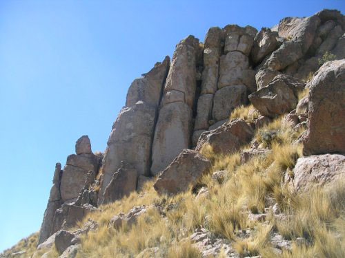
At first sight, and from a distance, Pukara Grande appears to be just a natural outcrop.
It was my own use of computerised maps of the globe that enabled me to plot the Way of Viracocha in spherical geometric space, coupled with what can only be termed synchronicity, which led me to yet another discovery. Sholten D’Ebneth had identified the starting point of the alignment at Tiwanaku, but as I mentioned at the beginning of this article, subsequent researchers had extended it to the Southeast, as far as the city of Potosí in southern Bolivia.
When I came to trace the Way for myself on the computer, I found that Potosí actually lies well to the south of the alignment. This was presumably because earlier researchers had used maps with a flat Mercator Projection. By way of contrast, my plotting of the alignment crossed what looked like an insignificant hill set amongst the mountains and valleys, just to the east of the Andean Lake Poopó.
In late 2013, I was travelling overland from Buenos Aires to undertake some more research work in Bolivia and Peru. I had reached the Bolivian border town of Villazon and had bought a train ticket there to take me further north. I decided to reserve some accommodation in the mining town of Oruro, at the end of the railway line that in earlier times used to run all the way from Buenos Aires to La Paz. When making my booking on the Internet, I was intrigued to find a hostel called the “Explorers Inn,” with the even more intriguing sub-title of “Atlantis in the Andes.” I wondered if there was perhaps something we could learn from each other – I decided to book a room there and went off to board my train.
It was not until after my first night at the Explorers Inn, when I was chatting with the owner over breakfast, that the subject of the “pyramid” came up in the conversation. The owner was soon joined by the Tour Manager at the Inn, Luis Gutierrez, who elaborated on the subject of the “pyramid” (it is mostly known as Pukara Grande, which means Great Fortress, but is also misleadingly called Inka Pukara). The “pyramid” was, I was told, what appeared to be a large hill, directly to the South-east of Oruro, near a small mining town called Huanuni.
Luis Gutierrez crouched at an entrance to the Pukara Grande situated on its roof.
Luis had spent his youth wandering the southern altiplano of Bolivia, exploring archaeological sites and gathering legends and traditions from the local Aymará people about their history and culture. As a result, he has acquired a deep understanding of the indigenous traditions in this little-known part of the Andes. His work has led him to some very different conclusions from the academic archaeologists about Andean prehistory, particularly concerning the antiquity of Andean civilisations. Luis’ knowledge of the region was also instrumental in helping Jim Allen’s pioneering work around Lake Poopó and Pamapa Aullagas.
He told me that the Pukara Grande was one of the most ancient huacas, held sacred to the local people and that, for this reason, it was never to be mined. Although it looked just like a hill from below, it actually has a massive vaulted roof, which spans most of its summit. There are also entrances, with staircases, some of which are spiral, that descend from the roof entrances to the interior. From here, the stairs are said to extend into a network of tunnels and passageways. The few expeditions that have ventured inside the Pukara Grande have discovered massive blocks of precisely cut andesite supporting what must be the immense weight of its roof.
Precisely cut and fitted megalithic blocks within the Pukara Grande
It did not take much persuasion on Luis’ part for a visit to be arranged to Pukara Grande, which would, of course, have needed to include a meeting with a local elder first. It was a little later, when Luis and I were discussing our various research interests one evening, that the realisation occurred. It turned out that Pukara Grande was indeed the apparently insignificant hill I had noticed, when extending the Way of Viracocha beyond Tiwanaku and through Oruro, on the computer screen!
Although the Pukara Grande appears to be a natural hill from a distance, the vertical stacks of rocks in this picture appear to function as buttresses. Note that the rocks display signs of having been worked and there is a rectangular stone at the base of the second stack from the left.
When Luis told me of the local legends concerning Pukara Grande, the significance of the place really started to dawn on me. There were legends of tunnels stretching for many miles and of armour clad mummies. However, the most telling story he told me concerned a great flood that had swept towards the monument along the altiplano from the north. The rush of water was accompanied by fire raining down on the land from the heavens and by earthquakes. All of this occurred when, so the locals say, the Sun went dark. Understandably terrified, the population of that time had taken refuge inside the tunnel system beneath Pukara Grande.
This account struck a particular chord with me, because it was so similar to ones I have read and listened to concerning the sudden and acute changes in climate that took place at the very end of the last Ice Age. This period was the final reprise of the frozen Pleistocene era, lasting from around 10,900BC to 9,500BC.xxxii Geologists call this sudden and extremely cold snap the Younger Dryas, which provided an icy punctuation to a gradual melting that had started before 13,000 years ago. Perhaps in as little as a few days, temperatures suddenly plunged back into the bitterest cold once again. It was an almost instantaneous big freeze that lasted for about 1,400 years, before an equally sudden warming took place, heralding the modern Holocene era. There is now a growing body of very tangible geological evidence that this rapid cooling was the result of a series of objects from outer space colliding with the surface of the Earth 12,800 years ago. The collisions, which were probably the fragments of a very large comet or meteorite, produced “multiple outbursts” that cannot be explained by means of “any known terrestrial mechanism.”xxxiii
This period of around 13,000 years ago also coincided with an equally sudden mass extinction of many of the Pleistocene’s largest mammals, such as ground sloths, sabre-toothed cats and mammoths. Almost three-quarters of the mammal species in North America were rendered extinct at this time. What is much less well known is that some 80% of South America’s largest mammal species disappeared equally suddenly during exactly the same period.xxxiv Whatever collided with the Earth’s surface had plunged most of the planet into over a thousand years of frozen wastelands and ice sheets. South America most certainly did not escape the effects of this immense and violent impact, or series of impacts.
This new information has led me to wonder – if any objects crashing into the Earth, or perhaps the Pacific Ocean, may have generated an immense tsunami? Funnelled between the two chains of the Cordilleras on either side, a tsunami could well have swept southwards along the altiplano, devastating all that lay before it. I could not help but remember what Posnansky had found when studying the different salt levels in the various pockets of water trapped in the Andes. His conclusion that there had first been sea-water flooding, followed by fresh water floods from melting glaciers, is consistent with what is now emerging as the sequence of events in the Younger Dryas. Even though Posnansky had known nothing about any collisions with comets or meteorites at the end of the last Ice Age, his findings would seem to support such a hypothesis. Was a tsunami racing along the altiplano in those far-off times really the basis for the legends that speak of devastation and the inundation of the lands surrounding Pukara Grande? If it was, then it may have immense significance for the dating of this and other sites along the Way of Viracocha.
More work needs to be done
Luis Gutierrez is keen to explore the interior the Pukara Grande further, but this work is fraught with potential dangers. The few expeditions that have penetrated to any depth into the site so far have revealed an interior structure consisting of rectangular and triangular megalithic blocks, cut with the same intricate precision that I have seen elsewhere in South America. (See figure 16, above). To my mind at least, this puts things beyond any doubt that this is an artificial construction. It is equally clear that Pukara Grande has suffered significant structural damage, making the exploration of its deep interior hazardous. If we are to know more about what really lies within its mysterious structure, it will require a fully equipped team of trained speleologists, including some members who possess geological, geophysical and archaeological knowledge. Until that time, Pukara Grande will remain a mystery and an enigma.
There are still even more mysteries to be fathomed in and around the village of Huanuni and across the vast reaches of the southern altiplano. There appear to be sophisticated stellar observatories, ancient roadways that may pre-date the Incas by many thousands of years, and what seems to be a massive staircase sculpted into the side of a mountain. These sites, if indeed they are traces of ancient human cultures, suggest that there were sophisticated peoples far more ancient, and of unknown provenance, than have hitherto been considered possible in South America. All of these phenomena need to be scrutinised and evaluated. Beyond all of this, the greater mystery of the Way of Viracocha has yet to reveal many of its deepest secrets to the modern world.
Dave Truman
Buenos Aires,
December 2015.
References
1 Andean star guardians consisted of two kinds of constellation: asterisms depicting animals in the heavens (like the animal constellations with which we are familiar) and dark cloud constellations, that were set like black jewels against the bright band of the Milky Way. The Incas envisioned these dark cloud shapes as the animal forms of the llama, the fox, the toad, the puma etc.
2 Inca society operated a solar and a lunar calendar simultaneously. Each delineated the separate rituals and festivals performed by men and women respectively during the year.
i Sholten D’Ebneth, Maria, La Ruta de Wiracocha, Editorial Juan Mejía Baca, Lima, 1977.
ii See Jim Allison’s work on the ancients’ use of Great Circles and spherical trigonometry: http://home.hiwaay.net/~jalison/index.html
iii Posnanasky, Arthur, Tiahuanacu, La Cuna del Hombre Americano, Archivo y Biblioteca Nacionales de Bolivia, p23, http://200.87.17.235/bvic/Captura/upload/TI_T- I-P12345.pdf
iv Milla Villena, Carlos, Génesis de la Cultura Andina, Colegio de Arquítectos del Perú, Lima, 1983, p59.
v Génesis de la Cultura Andina, p61.
vi Buero Rojo, Hugo, Buero Rojo, Sonia, El Imperio del Sol: Titicaca, El Lago Sagrado de los Incas, Tiwanaku, Cusco, Machupicchu, Editorial Hispania, La Paz, 1987, pp100-101.
vii Vidler, Mark, The Star Mirror, Thorsons, London, 1998, pp140-148.
viii See: Elaide, Mircea, Shamanism: Archaic Techniques of Ecstasy, Arkana Books, London, 1989, p206.
ix See: David, Gary A, The Orion Zone: Ancient Star Cities of the American Southwest, Adventures Unlimited Press, Kempton, Illinois, 2006, pp38-56.
x de Santillana, Giorgio, and von Dechend, Hertha, Hamlet’s Mill: An Essay Investigating the Origins of Human Knowledge and Its Transmission Through Myth, 1977, p242: http://www.bibliotecapleyades.net/hamlets_mill/hamletmill.htm
xi See: Sullivan, William, The Secret of the Incas: Myth, Astronomy, and The War Against Time, Crown Publishers, New York, 1996, p239
xii The Secret of the Incas, p61.
xiii See: La Violette, Paul, Genesis of the Cosmos, Bear and Company, Rochester, Vermont, 2004.
xiv See: Lajo, Javier, Qhapaq Ñan: La Ruta Inca de Sabiduría, Centro de Estudios Nueva Economía y Sociedad, Lima, 2005.
xv Rutherford, Ward, Pythagoras: Lover of Wisdom, Aquarian Press, Wellinborough, 1984, pp87-93.
xvi Carlson, Randall, Cosmic Patterns & Sacred Architecture, Red Ice Radio interview, February 2013, http://www.redicemembers.com/secure/radio/program.php?id=681
xvii See Jim Allen’s work on measurement systems in the ancient Andes: http://www.atlantisbolivia.org/tiwanakucubits.htm
xviii See: Hancock, Graham, Fingerprints of the Gods, Heinemann, London, 1995.
xix Hamlet’s Mill, p8.
xx Michell, John, The Dimensions of Paradise: Sacred Geometry, Ancient Science, and the Heavenly Order on Earth, Inner Traditions, Rochester Vermont, 1971.
xxi Munck, Carl, The Code, DVD box set, UFO TV, 1982
xxii See: Hapgood, Charles, Maps of the Ancient Sea Kings, Adventures Unlimited Press, Kempton, Illinois, 1996.
xxiii See: http://www.faculty.ucr.edu/~legneref/archeol/fuentema.htm and http://reydekish.com/2013/12/18/evidencia-de-los-sumerios-en-altiplano/
xxiv Shamanism, p267.
xxv See: The Secret of the Incas, pp88-89.
xxvi Tompkins, Peter, Secrets of the Great Pyramid, Penguin Books, New York, 1978, pp184-185.
xxvii Tiahuanacu, La Cuna del Hombre Americano, p78.
xxviii Fernandez-Baca Tupayachi, Carlos, Saqsaywaman: A Model of Atlantis, the Untold Story, Munaypacha, Lima, 2006, p161.
xxix See: Sarmiento de Gamboa, Pedro, La Historia de Los Incas, http://www.ellibrototal.com/ltotal/?t=1&d=3592_3705_1_1_3592
xxx Hatcher Childress, David, Lost Cities and Ancient Mysteries of South America, Adventures Unlimited Press, Kempton, Illinois, 1986, p98.
xxxi See: Ancient Technology in Peru and Bolivia, UFO TV, Adventures Unlimited series, 2011.
xxxii See: Schoch, Robert M, Forgotten Civilization: the Role of Solar Outbursts in our Past and Future, Inner Traditions, Rochester Vermont, 2012; Expanded Perspectives’ interview with Andrew Collins, http://www.expandedperspectives.com/andrew-collins-gobekli-tepe-genesis-of-the-gods/; & Carlson, Randall, Sacred Patterns and Cycles of Catastrophe, (DVD), Sacred Geometry International, 2012.
xxxiii Israde-Alcantara, I. Bischoff, J. L. Dominguez-Vazquez, G. et al, Evidence from central Mexico supporting the Younger Dryas extraterrestrial impact hypothesis, Proceedings of the National Academy of Sciences, Volume 109, Issue 13, 2012, p1: http://www.pnas.org/content/109/13/E738.full.pdf+html
xxxiv Chilton, Rod, Younger Dryas Climatology Explained in Detail, Pleistocene Coalition News, Volume 4 Issue 4, July-August 2012, pp18-19: http://pleistocenecoalition.com/newsletter/july-august2012.pdf#page=18
Excellent!
Wow! What a read! Excellent scholarship and such exciting developments. I’m particularly intrigued with the compass anomalies in the presence of the chakanas — What’s that about? I look forward to more, more, more!
More sacred geometry regarding Caral Peru can be found at http://www.thefaramfoundation.com
Thanks Bethany. I’m still working out the significance of the anomalous compass readings. I visited Tiwanaku again on Sunday and checked the diamond-shaped stone with the compass once more. (I managed to film it this time too). This time, it gave a reading where the needle pointed consistently to magnetic SE. Again, the reading aligned with the Way of Viracocha, but exactly opposite to the 45deg NW reading. It confirms my hunch that this magnetic anomaly has somehow been engineered. I have some ideas about this, but you’ll need to wait until the book comes out, I’m afraid.
The concept of Tsunami is definitely in line with Randall Carlsons cataclysmic hypothesis. If you pull up your Google earth you can see very easily the riffles left behind as the ocean waters flowed back into the ocean running all along the high plateau to the east of the Tiwanaku site. Also, visible is the Runnel or riffle created in the ocean bottom as the returning flush dug into the sea bed all along the impacted coastline from southern Mexico to the tip of South America. This also explains the salt waters of the inland lakes, the massive flooding as the tsunami returned to the sea and the extensive buried structures discovered beneath the surface of the present day landscape and the numerous salt deposits and flats associated with this massive intrusion of ocean caused by an impact at sea. There is so much coming to light and it is getting more exciting by the day. Thank you for your brilliant insite.
Thanks for this Roger. I shall follow up your suggestion. I realised that I was speculating somewhat when I wrote that part of the article. When I get back to Britain next month, I need to find some solid evidence to support my speculation, so your information is very useful. You;re quite right, there is so much evidence coming to light now. I think we really do live in exciting times.
Thanks Dave. I’ve recently stumbled on another alignment you may be interested. For what it’s worth the line from the American Stonehenge located in New Hampshire, USA through the British Stonehenge and ending at Galgal Refaim, Israel Golan Heights (Iraeli Stonehenge) is only off approximately .015 degrees, hardly circumstantial. It’s not so much the alignment but the angle the circumspection takes in relation to possible cosmic projections.
This area of the Golan Heights is another of the unexplored finds like Gobekli Tepe that may reveal some startling insights to our ancient history. But the threat to life and limb of this area prohibits any extended excavations.
One last alignment I’ve noticed is Teotihuacan (Mexico City)Sun Pyramid in line with Cuicuilco Pyramid, some claim to be the oldest pyramid on earth and the volcano that destroyed the Zapotecan metropolis it was associated with, Xitle. This led to the exodus of the Zapotecans to the hilltop complex known as Monta Alban, near Oxaca Mexico.
Some food for thought. I’ve just begun Hancock’s, Magicians of the Gods. It’s like Christmas all over again with this read. Best of luck with your pursuit. I think you are definitely on track with some irrefutable evidences you will see come to fruition. On one last note, of Carlson’s cataclysmic impact hypothesis. I lived in the area of Clark Fork where the flood waters had exploded through the river drainage when the Missoula Sea drained 11,800 years ago. A recreational gold prospect friend of mine told be he was finding alluvial deposits of gold 1100 feet above the valley floor! That would put the bottom of the flood waters from this meltdown at 1100 feet above the valley floor. So your speculation that a tsunami scaled the 10,000 foot elevation in the Tiwanaku plain within reason and the evidence is clear. I’ve got no doubt.
Thanks again Roger for your informative and supportive comments. I’m due to get in touch with Cort Lindahl via Skype in the next few days. I think what you’ve said about the other alignments will be of as much interest to him as they are to me. Would you mind if I passed your comments on to Cort?
Cuicuilco is certainly an intriguing pyramid and I think it is probably very ancient. Curiously, I came recently across a fascinating series of archaeological discoveries near Cajamarca, at the northern end of the Way of Viracocha. The findings predate the Caral Pyramid by some 1,500 years and, at 5,500 years BP, are considered the oldest in Peru – at least in terms of conventional dating: http://redhistoria.com/descubren-una-civilizacion-de-5500-anos-en-peru/#.VpaklGHWRHX
What’s so interesting about this unknown culture is that this unknown culture constructed conical pyramids – just as at Cuicuilco. I have yet to check out any specific alignments etc, as I’m busy in Bolivia at the moment, but it all looks fascinating. Apart from anything else, even the conventional dating for advanced cultures in the Andes is having to move further and further back in time.
Thank you for your interest in this area of the world and for shining some light…I am personally interested in Pukara (exact equidistance between Cuzco and Tiwanaku). If you pass by Pukara could you please do a compass reading? Easy access: Just by the side of the road in front of the Torito de Pukara handicraft stores,you just cross the road toward the Penon. I had a very strange experience there regarding electromagnetic or Ceke field. Do you have any information regarding Pukara? I was there a few years ago while UCLA archaeologist were doing some fieldwork so I did not have access to certain areas I was interested in exploring. Ditto for Chavin de Huantar but I did manage to explore the area a few days before the Stanford U archaeological team came in and blocked all access…I arranged to spend a full moon night at the site and roam around…fascinating! The water-mirrors are also present in Chavin de Huantar, in the lower part of the courtyard, etched in a large stone on the ground.
What you say Sophie is very interesting. Firstly, it seems as if there is a desire, at least amongst some “conventional” archaeologists, to censor evidence at sites, before they have had the opportunity to fit it into an existing paradigm. That’s certainly been my experience at Tiwanaku.
Unfortunately, I can’t go to Pukara, or Chavin, this year. I have only a few days left on my passport stamp for Bolivia and I need to return to Argentina, before flying to England. I have been to both sites recently, however and have taken plenty of photographs at both.
Pukara interests me, because the two artifacts mentioned in the article that have cuneiform script also display graphics in the style of this culture. Apart from anything else, this would suggest that the dating of the Pukara culture is rather earlier than the academic consensus, at around 3,100BC. I also found some of the exhibits in the museum in Pukara fascinating for a number of reasons.Several human statues had a distinctive “Egyptian” feel to them. (There is one human head there that has a serpent emerging from the subject’s forehead in a characteristically pharaonic manner. Another human head has a falcon behind it). It’s difficult for me to go into all of the ramifications here, but I’m inclined to agree, rather unfashionably nowadays, that the earliest Egyptian dynasties were linked to Mesopotamia, especially the Shemsu Hor. Even more controversially, I think that there are also grounds for suggesting linkages with the origins of the Incas to the Shemsu Hor. (Long before they came to prominence, the Incas’ tribal totem was a falcon named Inti – also, of course, a solar deity). Anyway, I can’t do justice to all of this here and there is plenty more circumstantial evidence. 3,100BC is also a possible date for a later cataclysm that curiously coincides with the start of the Mayan long-count calendar.
I also took many photographs at Chavin de Huantar with an Oldfield filter, which may particularly interest you, given your comments about the site. Some of them do appear to show an especially “charged atmosphere”. I also wanted my visit to coincide with the full moon, but practical problems got in the way. I’d be happy to share any pictures I have of Pukara and Chavin via FB, if you have an account. Sorry for the rambling reply.
Thank you so much for your reply. Yes! I would be interested in seeing those photographs from Chavin and Pukara! I would also like to send you some interesting info regarding Chavin, Puno(my grandmother’s birthplace)and other places. I must admit I am ‘technologically challenged’ by choice ,not too keen about the ‘screens’ but I have great penmanship. Being a low profile person, I am not comfortable with this kind of communication (not private at all), specially when discussing certain subjects. Could you send me those photographs to my personal email? If so, maybe I could send you the info in a long email or write a long letter to you. I try to be cautious. Thank you for understanding and I hope we can continue this exciting exchange of views about ancient civilizations and more .